
 SetPaying for Seoul transport
 Hi, I’m SeoulAslan
Jongno Trail Course 3 Naksan: City Wall, Night View (2026)
Checked Oct 16, 2026
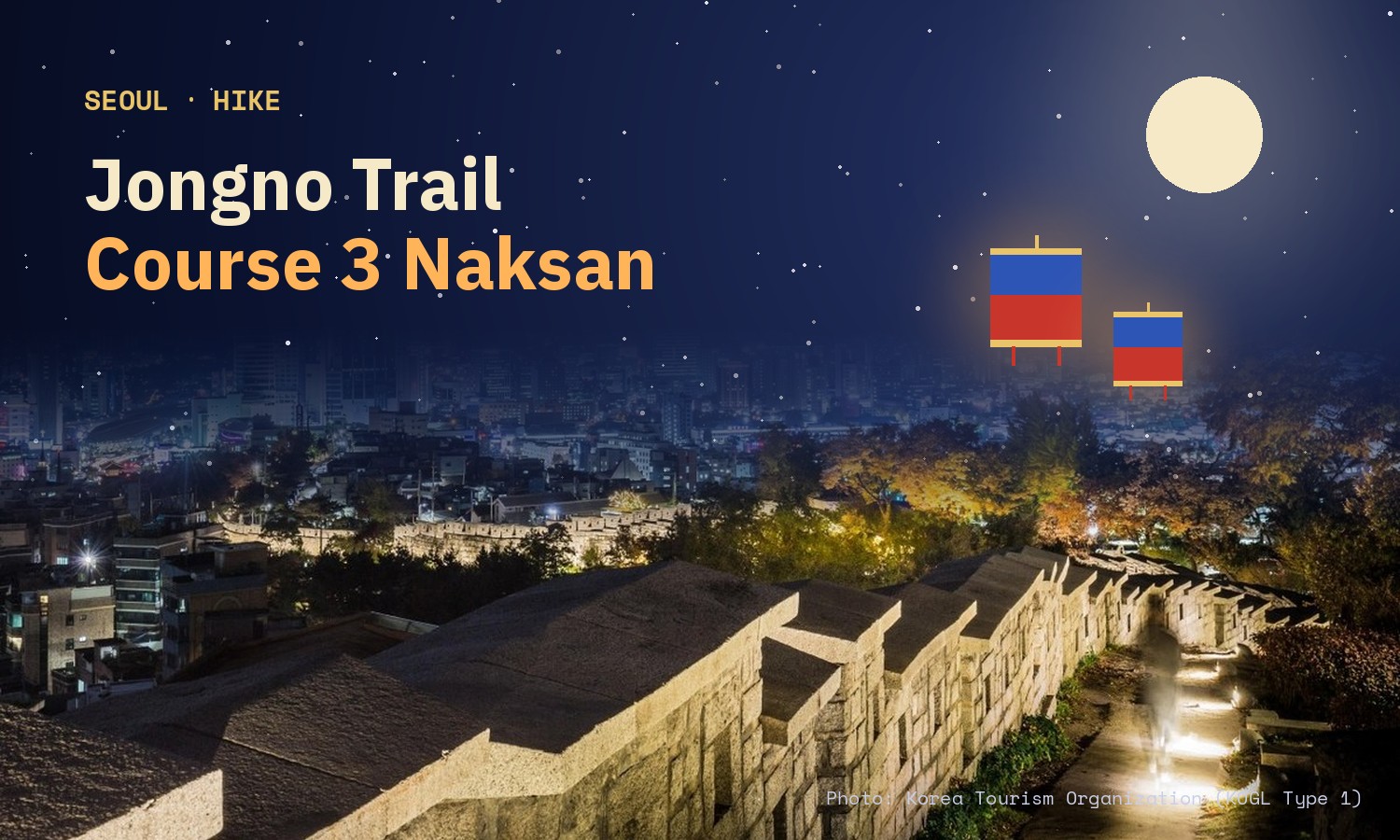
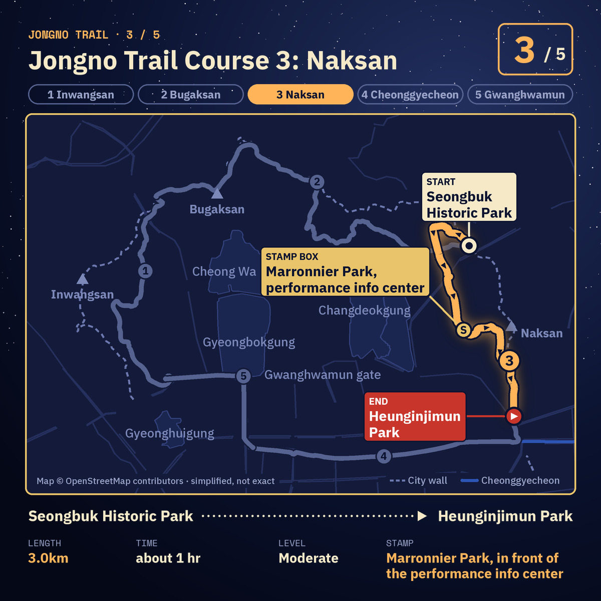
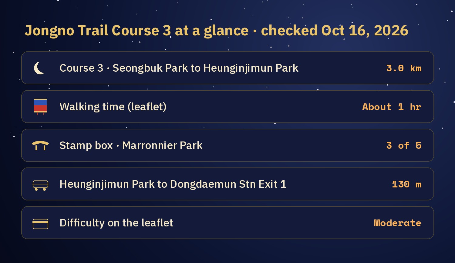
Course 3 of the Jongno Trail (종로둘레길) is the Naksan (낙산) section: 3.0 km, about 1 hour, rated "moderate" on the official leaflet. It runs from Seongbuk Historic Park (성북역사문화공원) to Heunginjimun Park (흥인지문공원) beside Dongdaemun. The stamp box is at Marronnier Park (마로니에공원), in front of the performance information center. The second half is on the Seoul City Wall, and the leaflet recommends seeing the wall lit at night.
I think the Jongno stamp tour will do well, because the courses are put together so well. I have not walked Course 3 yet, so this guide follows the official leaflet map and city sources.
Jump to: What Course 3 is · Walking order · Stops worth a look · At night · Getting there · FAQ
What is Jongno Trail Course 3?
The Jongno Trail is a loop of 5 courses through central Seoul, 15.8 km in total. Course 3 starts where Course 2, Bugaksan ends, at Seongbuk Historic Park. The stamp tour and the certificate are explained in the Course 1 guide.
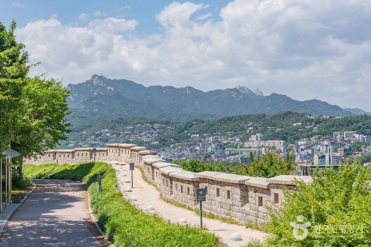
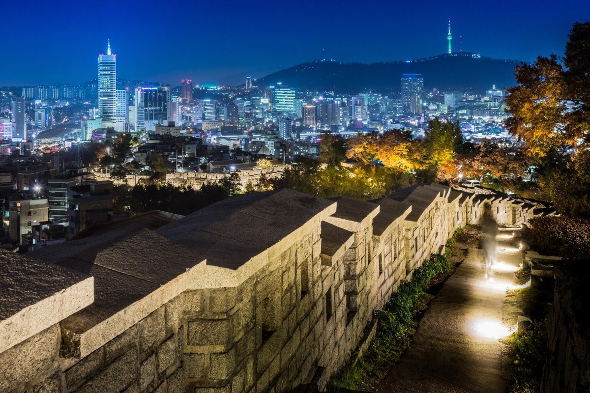
The leaflet calls this course "a city wall walk beautiful by day and by night". It says to enjoy the city view at Naksan Playground (낙산놀이마당) and then to see the lit wall. At 1 hour it is much shorter than the Bugaksan course before it.
In what order do you walk Course 3?
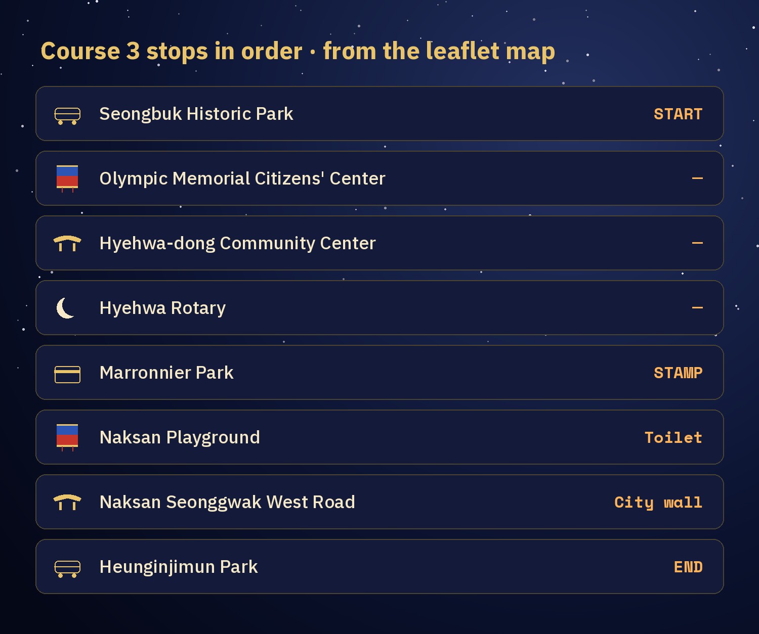
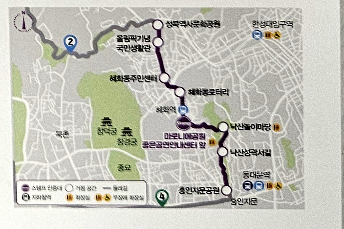
The leaflet map shows 8 stops. The first part is through city streets: Seongbuk Historic Park, the Olympic Memorial Citizens' Center (올림픽기념국민생활관), Hyehwa-dong Community Center (혜화동주민센터) and Hyehwa Rotary (혜화동로터리). You stamp at Marronnier Park.
After the park you reach Naksan Playground, then the Naksan Seonggwak West Road (낙산성곽서길), a path on the city wall, and the course ends at Heunginjimun Park. Course 4 starts there.
What is worth a stop on Course 3?
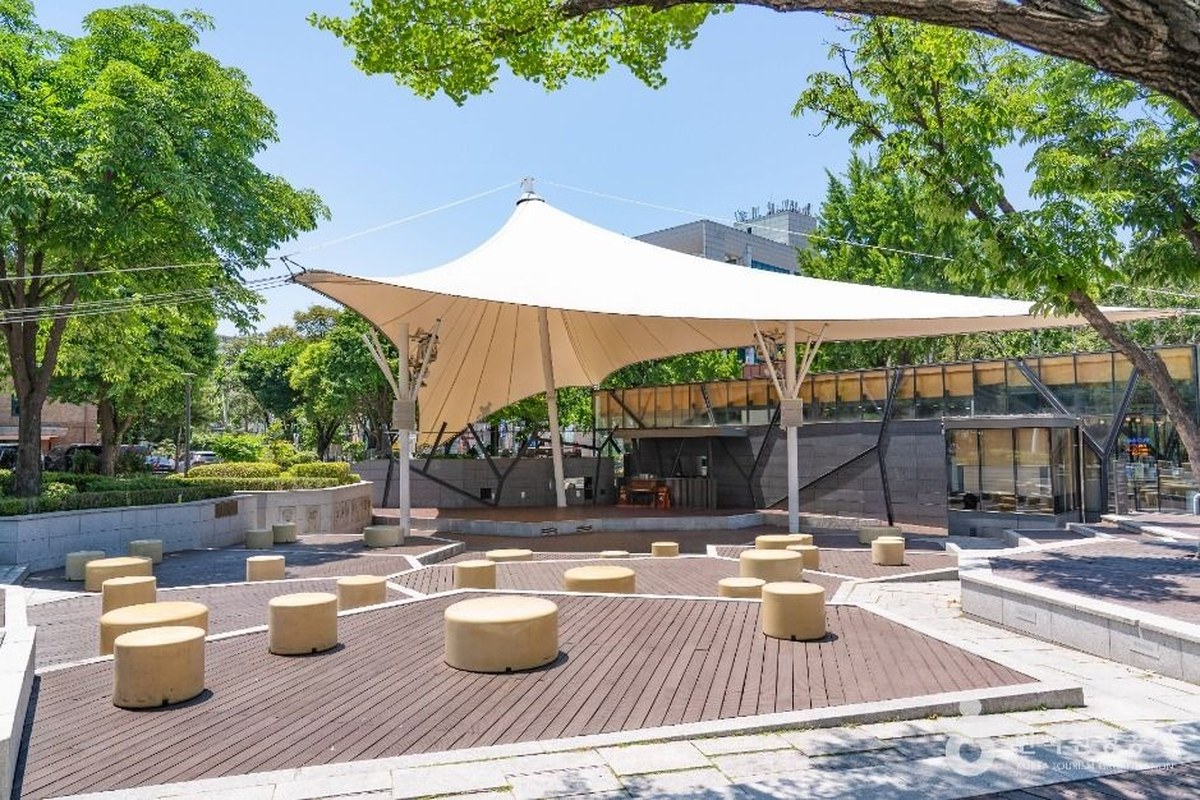
Marronnier Park (마로니에공원). It was made in 1975, after Seoul National University's liberal arts and law colleges moved to the Gwanak campus. It is named after the horse chestnut trees (marronnier). The park is open 24 hours and has an outdoor stage. Its performance information center, the "Good Performance Info Center" (좋은 공연 안내센터), gives information on shows across Daehak-ro, the theater street. The stamp box is in front of it.
Naksan Park (낙산공원). A hilltop park on the city wall, known for the Seoul skyline from its lookout. It is always open.
Heunginjimun (흥인지문) and Heunginjimun Park. Heunginjimun is the east gate of the old capital, commonly called Dongdaemun. The park next to it opened in 2010. It sits on the slope toward Naksan with the Hanyang Doseong Museum on the hillside at its east side. It is open year-round and free.
Can you walk Course 3 at night?
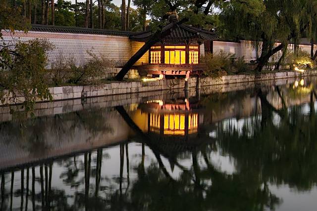
The leaflet recommends it. A city article says lights are installed below the wall, so you can walk between the lit wall and the glow of the village below. From the lookout you see the night skyline: Heunginjimun and Dongdaemun Design Plaza in the middle, and N Seoul Tower far away. The Seoul City Wall site lists its Naksan section as open 24 hours.
How do you get to Course 3?
- Start. Seongbuk Historic Park is near Hansung Univ. Station (Line 4) on the leaflet map.
- Middle. Marronnier Park is near Hyehwa Station (Line 4). From Hyehwa Station Exit 2, the top of Naksan Park is about 15 minutes on foot on the English page of the Seoul City Wall site. Its Korean page says 20 minutes to the park entrance and 5 more to the top.
- End. Heunginjimun Park is about 130 m from Dongdaemun Station (Lines 1 and 4) Exit 1.
For subway basics, see Seoul Subway Basics for First-Timers.
Naver Map pins
| # | Place | Naver Map |
|---|---|---|
| 1 | Seongbuk Historic Park (성북역사문화공원) · start | Open |
| 2 | Marronnier Park (마로니에공원) · stamp box | Open |
| 3 | Hyehwa Station (혜화역) | Open |
| 4 | Naksan Park (낙산공원) | Open |
| 5 | Heunginjimun (흥인지문) · end | Open |
| 6 | Dongdaemun Station, Exit 1 (동대문역 1번 출구) | Open |
New to Naver Map? Naver Map vs Kakao Map vs Google Maps in Korea explains it.
FAQ
How long is Jongno Trail Course 3?
3.0 km and about 1 hour, according to the leaflet and a 2024 city article.
Where is the Course 3 stamp box?
At Marronnier Park, in front of the Good Performance Info Center (좋은공연안내센터). In the app you must be within 100 m of it.
How does Course 3 compare with the Seoul City Wall's Naksan section?
They are not the same route. The city wall's Naksan section runs from Hyehwamun gate to Heunginjimun gate for 3.2 km. The English page of the Seoul City Wall site says about 1 hour and its Korean page says about 1 hour 30 minutes. Both give it 2 stars for difficulty (its Bugaksan section gets 5). Course 3 is 3.0 km and starts earlier, at Seongbuk Historic Park.
Is Naksan Park open at night?
The Seoul City Wall site lists the Naksan section as open 24 hours, and a city article describes lights below the wall.
Where does Course 3 lead next?
Course 3 ends at Heunginjimun Park, where Jongno Trail Course 4: Cheonggyecheon begins. I will update the Checked date here if the leaflet or the stamp spot changes.
More on the Jongno Trail
Sources
- Jongno-gu leaflet "Let's walk together, Jongno Dulle-gil" (같이 걸어요 종로둘레길, Korean) and the Jongno Trail signboard at Changuimun, seen Oct 14-15, 2026
- Seoul Metropolitan Government media hub (Korean): Jongno Dulle-gil opening article, Nov 2024 · Marronnier Park · Naksan Park night view · Heunginjimun and Heunginjimun Park
- Seoul City Wall (Seoul Metropolitan Government): Naksan Mountain Trail, English
- Photos: Korea Tourism Organization photo gallery, Korea Open Government License Type 1 (credited; cropped to size)
— SeoulAslan


Comments
Post a Comment