
 SetPaying for Seoul transport
 Hi, I’m SeoulAslan
Bugaksan Hike (2026): New Trail Now Open Since Oct 17, Routes, Rules
Checked Oct 16, 2026

Yes, foreigners can hike Bugaksan (북악산), also called Baegaksan (백악산) in official notices. It is free, there is no booking and no visitor cap. A new 1.32 km section on the southwest side opened on Saturday, Oct 17, 2026 at 9:00 am, the last closed part of the mountain. The easiest start is Changuimun gate (창의문), a 2-minute walk from a bus stop that you reach from Gyeongbokgung Station Exit 3. There is no parking.
I had wanted to climb Bugaksan for a long time. When I saw the news that the whole mountain was opening, I went on Wednesday, Oct 14. I didn't know the new path only opened on the 17th, so I walked the existing route to the summit. This guide covers what the mountain is, what opened on Oct 17, and how to walk it.
Jump to: What opened Oct 17 · Why it matters · My walk · Routes · Getting there · Rules · FAQ
What exactly opened on Oct 17?
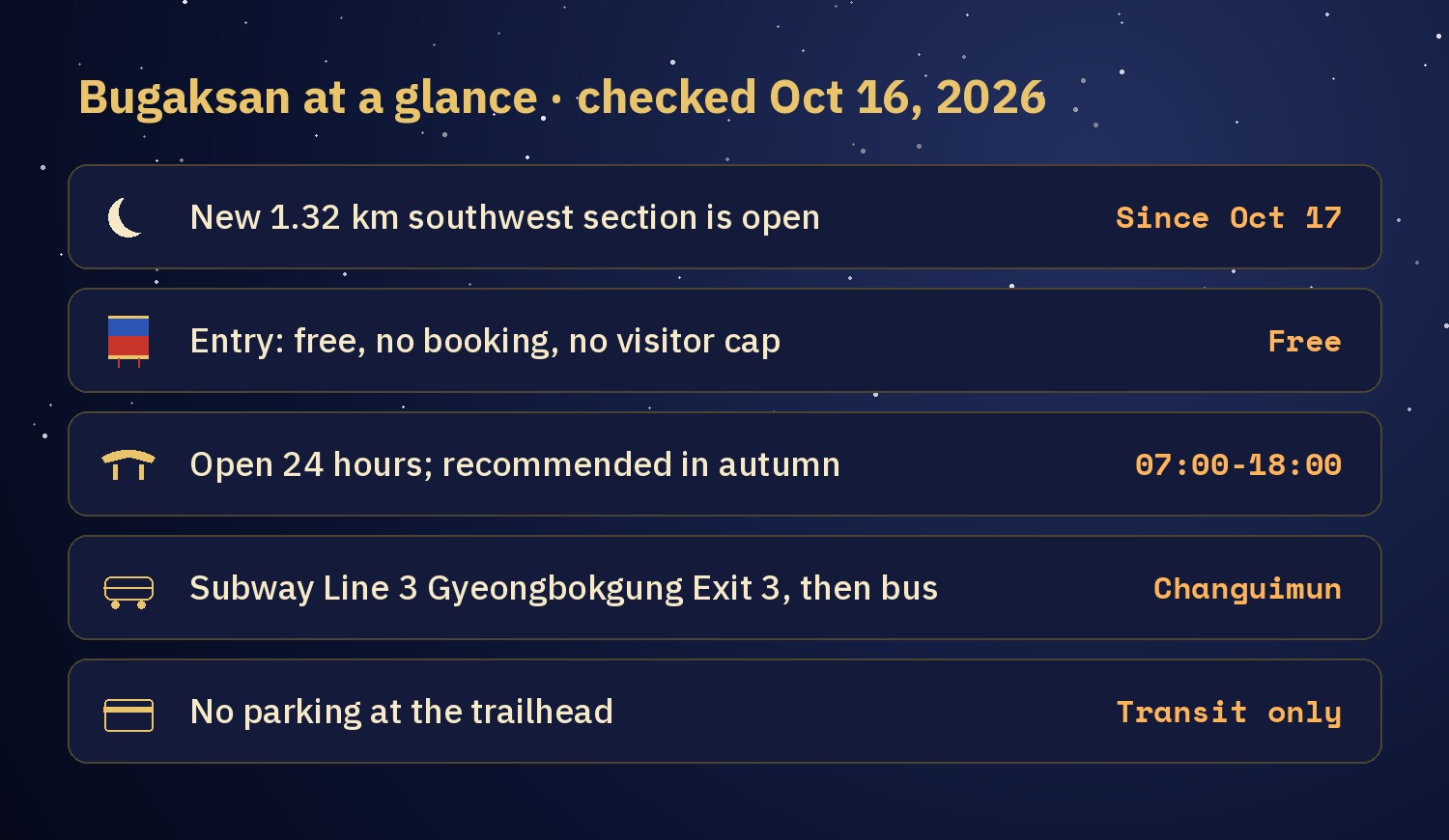
A new trail of 1.32 km on the southwest slope. The Korea Heritage Service says it starts at Dolphin Shelter (돌고래쉼터), the first rest stop on the way from Changuimun to the summit. It passes the fork for the Cheong Wa Dae viewpoint, then the Manse Dongbang spring (만세동방), where a rock is carved with a phrase wishing a king long life. It ends at the 1.21 Incident Pine (1·21사태소나무), a tree that still carries bullet marks. Four new viewpoint rest areas were built along it. The views run over Inwangsan, Namsan, Cheong Wa Dae, Gyeongbokgung and Gwanghwamun.
| Item | Detail |
|---|---|
| Opened | Saturday, Oct 17, 2026, from 9:00 am. A ceremony was held the day before, Oct 16 at 3:30 pm, at Changuimun. |
| Length | 1.32 km, from Dolphin Shelter to the 1.21 Incident Pine |
| Hours and cost | Open 24 hours, free. Use the designated trail only. |
| New viewpoints | 4 rest areas. No official list of names yet. |
| Who takes part | Korea Heritage Service, Presidential Security Service, Seoul city, Jongno-gu and the Korea Heritage Agency |
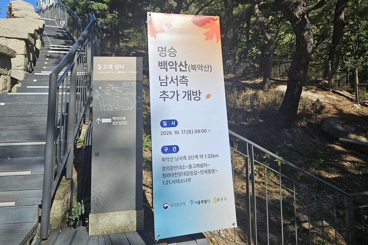
The new section is entered from the Changuimun side. When I was there on Oct 14, the entrance beside Dolphin Shelter was closed off by a white screen, and a banner announced the additional opening. The banner read Oct 17, 9:00.
Why does Bugaksan matter?
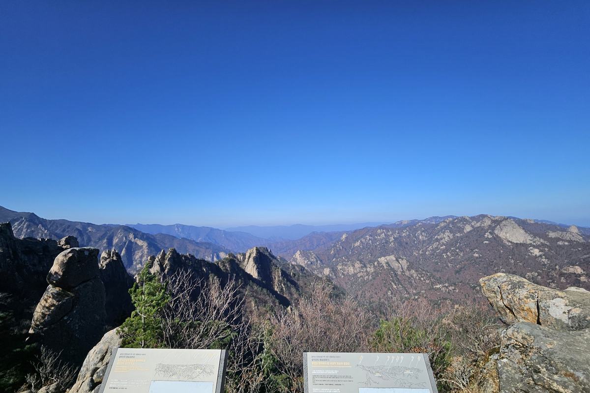
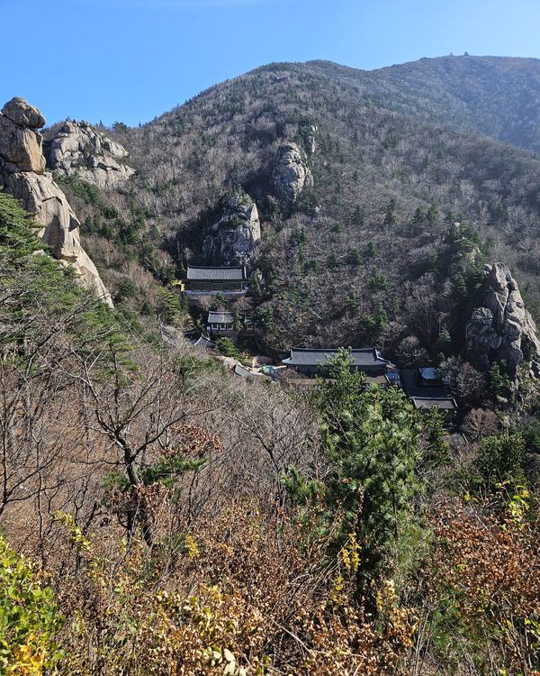
Bugaksan is the mountain right behind Cheong Wa Dae, the presidential compound. It is a 342 m granite peak. For decades most of it was closed to everyone.
The closure goes back to Jan 21, 1968. North Korean armed commandos crossed the border to attack Cheong Wa Dae and fought Korean soldiers and police on this mountain. After that the mountain was restricted. The 1.21 Incident Pine still shows the bullet marks from that fight. The government has reopened Bugaksan in steps:
| When | What opened |
|---|---|
| 1968 | Access restricted after the Jan 21 incident |
| Apr 1, 2006 | About 1.1 km from Hongnyeonsa temple to Candlestick Rock (촛대바위), with Sukjeongmun gate |
| Apr 5, 2019 | ID check dropped |
| Nov 1, 2020 | Stage 1: the north side of the Seoul City Wall behind Cheong Wa Dae (about 2.2 km, per the Korea Heritage Service) |
| Apr 2022 | Stage 2: the southeast forest around Samcheong Park and Cheongundae (about 3.0 km, per the Korea Heritage Service) |
| Jan 1, 2023 | Gates stop opening and closing; self-entry system |
| Oct 17, 2026 | Stage 3: the southwest slope, 1.32 km |
With stage 3, the Korea Heritage Service says, the main paths of the mountain join into one network, including the Seoul City Wall (서울 한양도성) that runs over the ridge.
What was it like when I walked up on Oct 14?
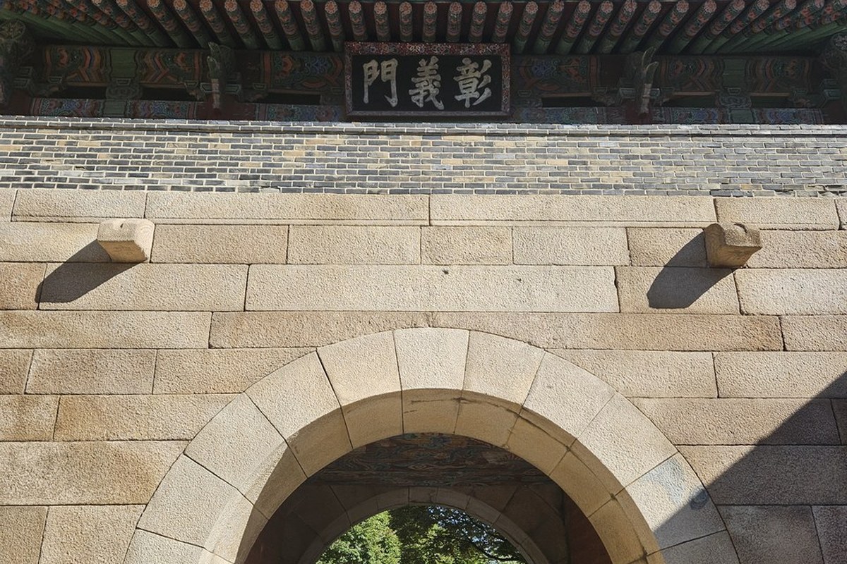
I arrived at Changuimun at 2:44 pm. It is one of the four small gates of the old city wall, and Seoul's city wall site says its gate tower is the only one of them that still stands from the Joseon era. The plaque reads 彰義門.
I started up the stairs at 2:58 pm. I passed Dolphin Shelter at 3:06 and stood on the summit at 3:28. That is 30 minutes from the first stair. I stayed about 8 minutes at the top, and was back at the gate at 3:59 pm. The way down took 23 minutes. Counting photo stops, the round trip was about an hour.
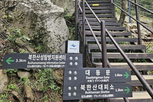
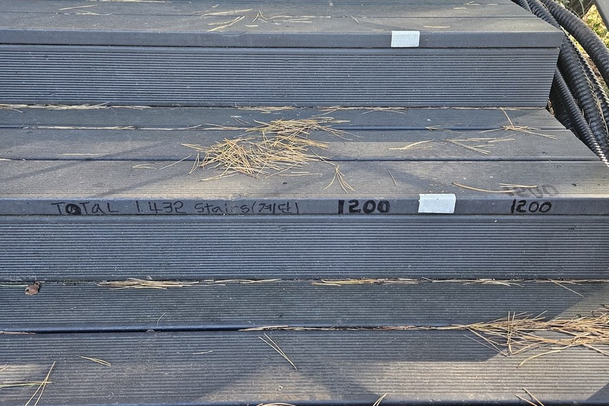
The path is almost all stairs. By my own measurement on OpenStreetMap, 0.75 km of the roughly 0.83 km from Changuimun to the summit is stairs. Someone has written a running count on the side of the steps in marker pen. Near the top it says "TOTAL 1,432 Stairs". That is hand-written, not an official number.
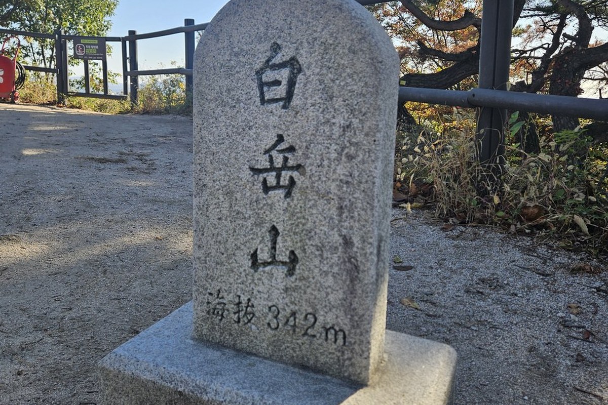
At the top there is a flat clearing and a stone marker. It is carved 白岳山 (Baegaksan) and 海拔 342m, the height above sea level.
Some signs along the way ask you not to take photos in certain directions. Follow them. The official rule is that photos are allowed only at designated spots.
Which Bugaksan route should you walk?
Seoul's city wall site rates the full Baegak section five stars out of five for difficulty. The shorter options are easier to plan.
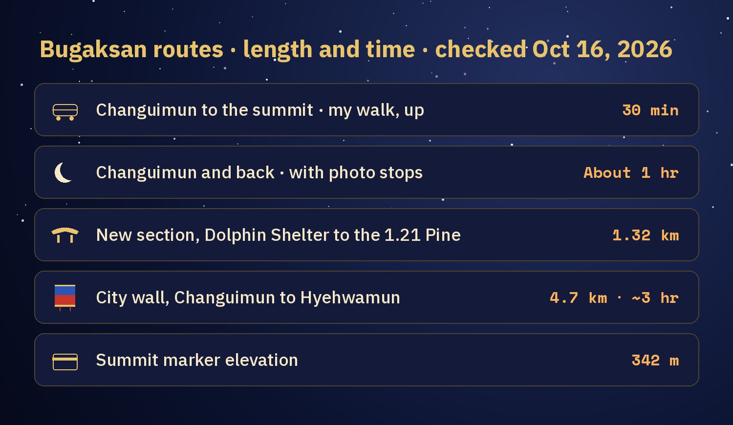
| Route | Length | Time | Notes |
|---|---|---|---|
| Changuimun to the summit and back | About 0.83 km each way (my calculation) | 30 minutes up, about 1 hour round trip (my walk) | Mostly stairs. Easiest to plan, and the one I walked. |
| Add the new section (open since Oct 17) | 1.32 km of new trail | No official time yet | Starts at Dolphin Shelter, ends at the 1.21 Incident Pine. Not walked by me yet. |
| Full Seoul City Wall, Baegak section | 4.7 km, Changuimun to Hyehwamun gate (혜화문) | About 3 hours (Seoul) | Passes Baegangmaru summit, Sukjeongmun north gate and Malbawi rock. |
Changuimun is the start for the new section. For the full wall, a Seoul media hub article recommends starting at Hyehwamun for less experienced walkers, because the Changuimun end begins with a steep climb. Hyehwamun is a 5-minute walk from Hansung Univ. Station (Line 4) Exit 5.
Walk in daylight. Seoul's recommended hours are 09:00 to 17:00 from November to February, 07:00 to 18:00 in March, April, September and October, and 07:00 to 19:00 from May to August. The trail is open 24 hours, but only these hours are recommended. For boots and poles, see Seoul Hiking Gear Rental.
How do you get to Changuimun from central Seoul?
- Take Subway Line 3 to Gyeongbokgung Station (경복궁역) and leave by Exit 3.
- Take a green branch bus (지선버스): 7212, 1020 or 7022.
- Get off at the Jahamun Pass (자하문고개) stop. Changuimun is a 2-minute walk.
Show the Korean names to the driver if you need to. For bus tapping and cards, see How to Ride a Seoul Bus and T-money vs Climate Card vs WOWPASS. There is no parking at the trail, so come by transit. Gyeongbokgung is nearby too; for palace dates, see Seoul Palaces Free Entry Oct 29 to Nov 15.
Naver Map pins
| # | Place | Naver Map |
|---|---|---|
| 1 | Changuimun (창의문) · trailhead | Open |
| 2 | Gyeongbokgung Station, Exit 3 (경복궁역 3번 출구) | Open |
| 3 | Yun Dong-ju Literary Museum (윤동주문학관) · near the bus stop | Open |
| 4 | Sukjeongmun (숙정문) · north gate on the wall walk | Open |
| 5 | Hyehwamun (혜화문) · other end of the wall walk | Open |
| 6 | Hansung Univ. Station, Exit 5 (한성대입구역 5번 출구) | Open |
New to Naver Map? Naver Map vs Kakao Map vs Google Maps in Korea explains it.
What are the rules on the trail?
The Korea Heritage Agency lists ten notes for visitors. The ones that matter most for first-timers:
- No parking. Use public transport.
- Stay on the designated trail.
- No smoking and no flammables, because of fire risk.
- No alcohol anywhere on the trail.
- Photos only at designated spots.
- No littering and no loud noise.
- Rest only at the rest areas, because the path is narrow.
- Avoid heavy snow, heavy rain and typhoons.
- Avoid night visits. The trail has no lighting.
- The agency is not responsible for accidents caused by carelessness.
FAQ
Can foreigners hike Bugaksan without a reservation?
Yes. It is free, with no visitor limit. The Korea Heritage Agency says the gates have not opened or closed since Jan 1, 2023, and the ID check was dropped in April 2019.
When did the new Bugaksan trail open?
Saturday, Oct 17, 2026 at 9:00 am. It is a 1.32 km section on the southwest side, open 24 hours and free.
How long does it take to climb Bugaksan from Changuimun?
It took me 30 minutes from the first stair to the summit, and about an hour for the round trip with photo stops. Almost all of it is stairs.
Which subway station do I use for Bugaksan?
Gyeongbokgung Station on Line 3, Exit 3, then green bus 7212, 1020 or 7022 to the Jahamun Pass stop. Changuimun is a 2-minute walk from there.
Can I visit Bugaksan at night?
The trail is open 24 hours, but the Korea Heritage Agency asks visitors to avoid night visits because there is no lighting.
Now that the new path is open
After the 17th I want to walk the new path too. When I do, I will add the real time and what each new viewpoint looks like to this page. If an official detail changes, I will fix it here and change the Checked date.
More hikes and nearby
More on the Jongno Trail
Watch the video
Sources
- Korea Heritage Service (국가유산청, Korean), press release on the three-stage opening of Baegaksan, Oct 14, 2026: Policy Briefing
- News reports of the Oct 13 and Oct 14, 2026 announcements (Korean): Kyunghyang Shinmun · Financial News
- Korea Heritage Agency, Baegaksan Hanyangdoseong (Korean): history of the opening · Changuimun information center and directions · self-entry rules · visitor notes
- Seoul City Wall (Seoul Metropolitan Government): Baegak Mountain Trail, English · Korean page with recommended hours and directions
- Seoul Metropolitan Government media hub (Korean): Baegak section highlights · southern section opening, Apr 2022 · Bugaksan wall walk · recommended hours
- Encyclopedia of Korean Culture, Seoul Baegaksan area (Korean)
- Map measurement: © OpenStreetMap contributors (my calculation, not an official figure)
- Photos: taken by me on Oct 14, 2026 (faces and location data removed)
— SeoulAslan


Comments
Post a Comment