
 SetPaying for Seoul transport
 Hi, I’m SeoulAslan
Bukhansan Fall Foliage (2026): Peak Dates, Trails, Subway
Checked Oct 11, 2026

Bukhansan National Park (북한산국립공원) is the autumn hike you can reach from central Seoul by subway and bus. The Korea National Arboretum's 2026 forecast puts Baegundae, the summit, and the Daenammun gate on Oct 25, and the valley path along the fortress wall on Oct 27 to Nov 1. The easy route is the Daenammun trail: 5.8 km, about 3 hours, rated easy by Korea National Park Service (KNPS). The famous summit is Baegundae, 3.4 km one way, rated moderate.
Jump to: Peak dates · Daenammun trail · Baegundae · Which day · Getting there · Food · FAQ
When does Bukhansan peak in 2026?
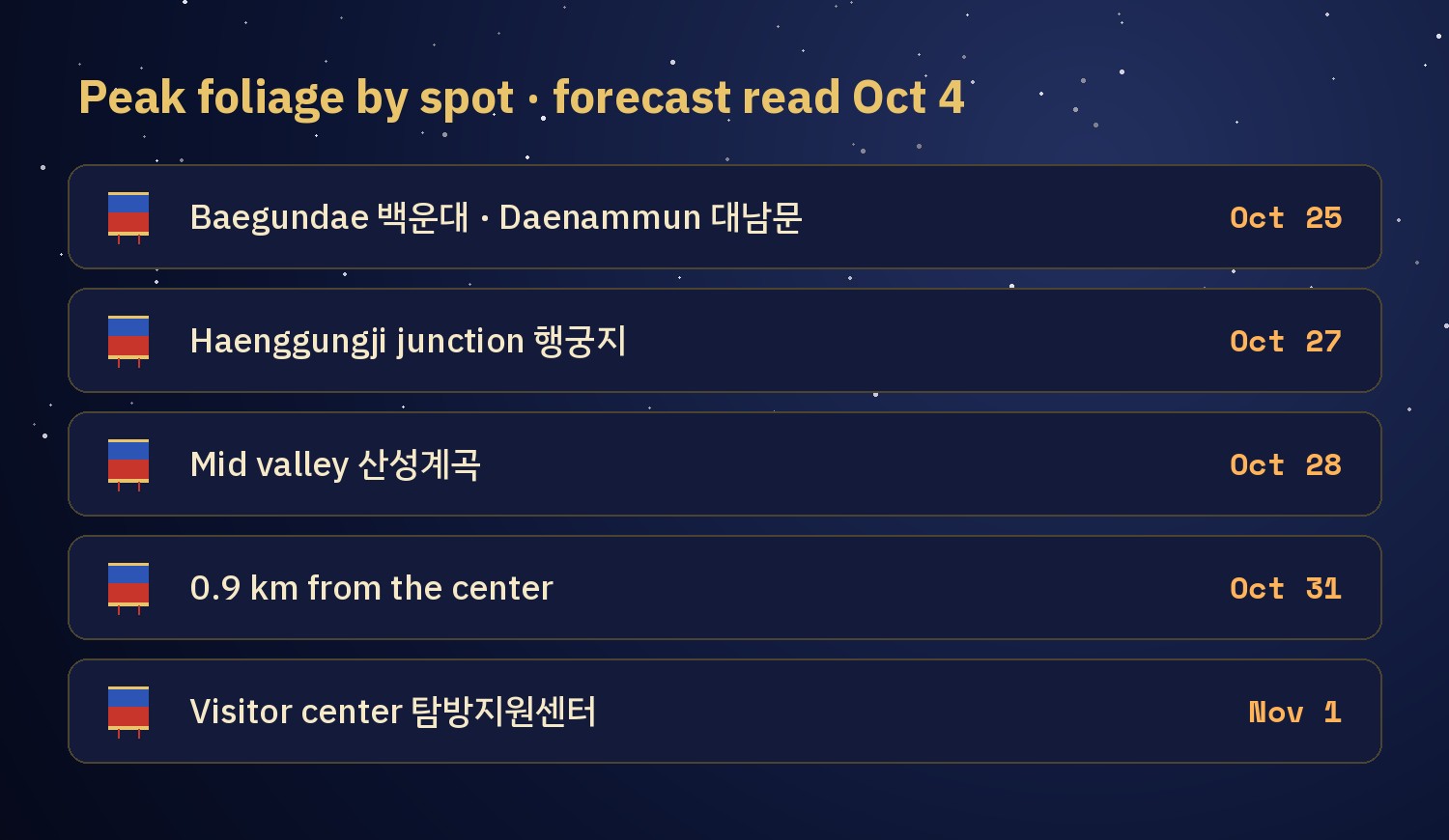
The Korea National Arboretum (국립수목원) runs a map where you tap a spot and get its forecast peak date. I tapped the Bukhansan spots on Oct 4 and again on Oct 5, with the same result. The model has a hit rate of about 70%, so read the order more than the exact day. The Korea Forest Service's Sept 22 forecast does not include Bukhansan.
| Spot | Where | Forecast peak |
|---|---|---|
| Baegundae 백운대 (summit) | Bukhansanseong Trail | Oct 25 |
| Below Wimun 위문 | Bukhansanseong Trail | Oct 25 |
| Daenammun 대남문 | Daenammun Trail | Oct 25 |
| Haenggungji junction 행궁지 삼거리 | valley path | Oct 27 |
| Mid valley 산성계곡 | valley path | Oct 28 |
| 0.9 km from the visitor center | valley path | Oct 31 |
| Bukhansanseong Visitor Center 탐방지원센터 | trailhead | Nov 1 |
You may have seen a later date. A forecast that went round Korean news in early September gave Bukhansan's peak as Nov 4, because it counts peak as about 80% of the whole mountain turned. The Arboretum gives a date for each spot instead. The two do not contradict each other: the summit goes first, and the whole mountain is done by early November. We went through the two definitions in our fall foliage overview.
The easy way: Daenammun Trail
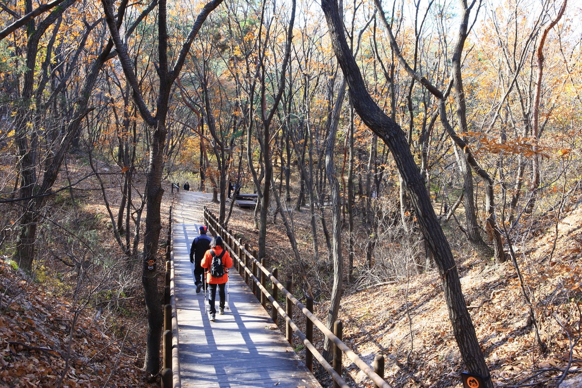
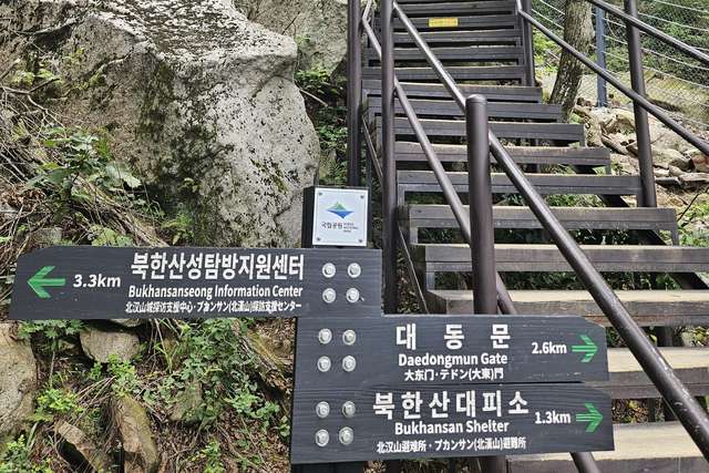
KNPS rates the Daenammun Trail easy and says it is worth seeing in autumn, and even children can walk it. It runs 5.8 km from the Bukhansanseong Visitor Center along the stream inside the fortress to Daenammun, the southernmost gate of the Bukhansan fortress wall. Plan about 3 hours one way.
- Visitor center → Jungseongmun 중성문: 2 km, about 1 hour. KNPS says it is the only gate inside the fortress.
- Along the way: a row of 26 stone memorials (Bisuk-geori 비석거리) and the Haenggungji 행궁지 palace site.
- Jungseongmun → Daenammun 대남문: 3 km, about 1 hour 30 minutes. KNPS says Nodeul-bawi 노들바위 is the hardest part.
Because the valley peaks Oct 27 to Nov 1, this trail suits the last weekend of October and the first days of November.
The summit: Bukhansanseong Trail to Baegundae
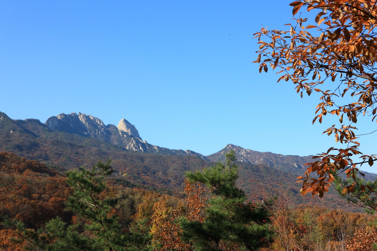
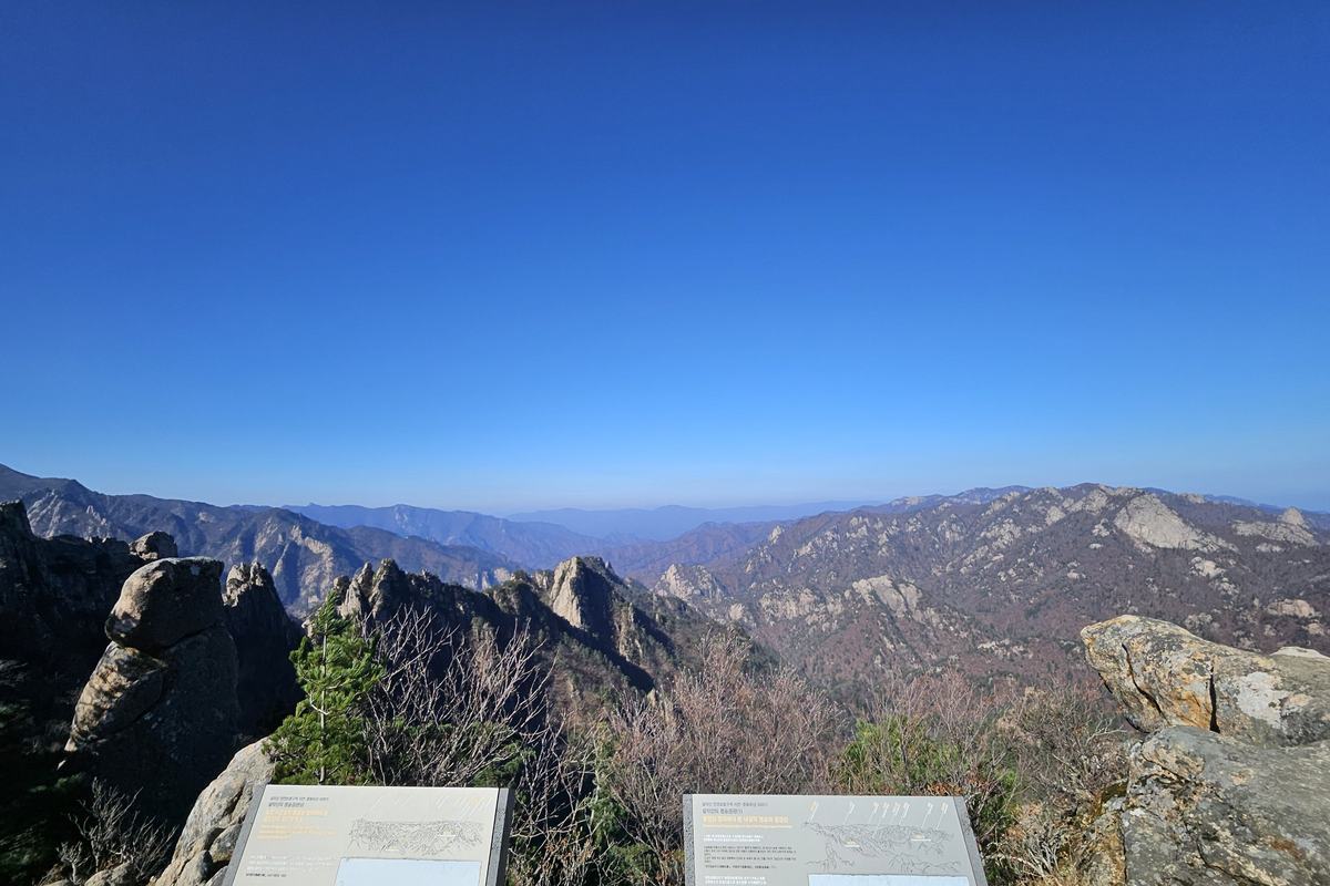
Baegundae (백운대, 836.5 m) is the highest peak, reached from the same visitor center. KNPS gives 3.4 km and about 2 hours 40 minutes one way, rated moderate. The start is a paved road, and from the middle it turns to stone path. The hardest part, KNPS says, is the 500 m from the Yaksuam site to the Baegunbong gate (백운봉암문), and Baegundae is another 300 m from that gate. KNPS recommends hiking boots and poles, and it marks areas around Baegundae as no-entry because of fall and lightning danger.
- Visitor center → Daeseomun 대서문: 0.8 km, about 30 minutes, the main gate.
- Daeseomun → Borisa 보리사: 1.1 km, about 40 minutes.
Bukhansan: which day to go
- Oct 24 (Saturday): Baegundae, one day before its forecast peak.
- Oct 31–Nov 1: the Daenammun valley, forecast for Oct 27 to Nov 1.
I went to Seoraksan a little after the announced peak and climbed all the way to the top, but high places lose their colour too early. Maybe it is because it gets warmer every year, or because the autumn two years ago was hot. The leaves were already burnt and gone. So for a summit I would go a few days before the forecast date, not after it.
How to get to Bukhansan from Seoul
- Take Seoul Subway Line 3 to Gupabal Station 구파발역.
- From Gupabal Station Exit 1, board bus 704 (KNPS also lists Yangju bus 37 and bus 34) to Bukhansanseong-ipgu 북한산성입구.
- Walk to the Bukhansanseong Visitor Center, Daeseomun-gil 45, Eunpyeong-gu, where both trails start.
I could not find an official ride time for the bus, so use Naver Map or Kakao Map for live arrival times. City buses take transit cards and most foreign contactless cards: see tapping a foreign card in Seoul. If you are coming from Daegu by KTX, KNPS lists about 2 hours 30 minutes from Dongdaegu to Seoul Station plus the subway and bus.
Bukhansan: parking, hours and closures
- Park entry: free. The KNPS fee page lists parking and camping only.
- Parking at the Bukhansanseong car parks 1 and 2 is by the hour: the first hour is 1,100 won, then 250 won per 10 minutes on weekdays, or 300 won on weekends and from Oct 1 to Nov 15 (small cars). From 9 hours it is a flat 13,000 won.
- Hours: start between 4 am and 5 pm from March to November, and between 4 am and 4 pm in December to February (KNPS entry-time table, checked Oct 12).
- Closures: as of Oct 4 the only one was the Gucheon valley (1.7 km, landslide), which is not on these trails. The park office is at +82-2-909-0497.
Eating on Daeseomun-gil
Restaurants line Daeseomun-gil (대서문길), the road to the visitor center. Ratings are Google Maps as of Oct 11, 2026, and I have not eaten at any of them. The links open Naver Map, where you can see Korean reviews and the menu. Google lists 산들애건강밥상 as closed on Mondays.
| Place | Google rating | Reviews | Map |
|---|---|---|---|
| 가야밀냉면해물칼국수 본점 Gaya Milnaengmyeon Seafood Kalguksu | 4.6 | 1,199 | 가야밀냉면해물칼국수 본점 |
| 만석장 Manseokjang | 3.9 | 664 | 만석장 |
| 산들애건강밥상 Sandeurae Healthy Table | 4.4 | 94 | 산들애건강밥상 |
FAQ
When is Bukhansan's fall foliage peak in 2026?
The Korea National Arboretum forecasts Baegundae and Daenammun around Oct 25 and the valley between Oct 27 and Nov 1. A news forecast using a stricter definition gave Nov 4 for the whole mountain.
How do I get to Bukhansan by subway?
Line 3 to Gupabal Station, then bus 704 from Exit 1 to Bukhansanseong-ipgu.
Is there an easy trail on Bukhansan?
The Daenammun Trail. KNPS rates it easy and says even children can walk it.
How long does Baegundae take?
KNPS lists 3.4 km and about 2 hours 40 minutes one way.
Bukhansan: the map as the weather moves
The Arboretum map moves with the weather. I will check it again and add what it says. You can check it yourself: open the Arboretum's peak foliage map, zoom to Bukhansan and tap the spot you plan to walk.
More fall foliage guides
- Korea Fall Foliage 2026: When Seoraksan and Naejangsan Actually Peak
- Pyeongchang in Fall 2026: Sky Ranch and Woljeongsa
- Odaesan Fall Foliage 2026: Peak Dates by Trail
- Hangyesanseong Trail, Seoraksan: Open After 50 Years (2026)
- Juwangsan Fall Foliage (2026): Peak Dates and How to Go
- Songnisan Fall Foliage (2026): Peak Dates and How to Go
- Jirisan Piagol Fall Foliage (2026): Dates and How to Go
- Gyeryongsan Fall Foliage (2026): Dates and How to Go
- Naejangsan Fall Foliage (2026): Dates and How to Go
Sources: Korea National Arboretum, 2026 peak foliage map (knpn.nature.go.kr), read Oct 4–5 · Korea National Park Service: Bukhansan course guide, transport, fees, entry hours and closure notices (knps.or.kr) · Korea Forest Service peak forecast, Sept 22 (no Bukhansan date) · Google Maps ratings, Oct 11 · Photos: Korea Tourism Organization, KOGL Type 1 · Satellite © VWorld, trails © Korea National Park Service
— SeoulAslan


Comments
Post a Comment