

 SetPaying for Seoul transport
 Hi, I’m SeoulAslan
Odaesan Fall Foliage 2026: Peak Dates by Trail
Checked Oct 5, 2026
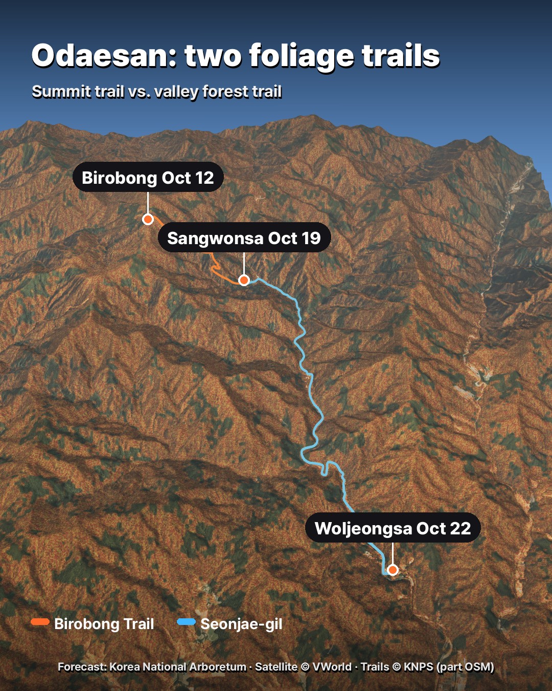
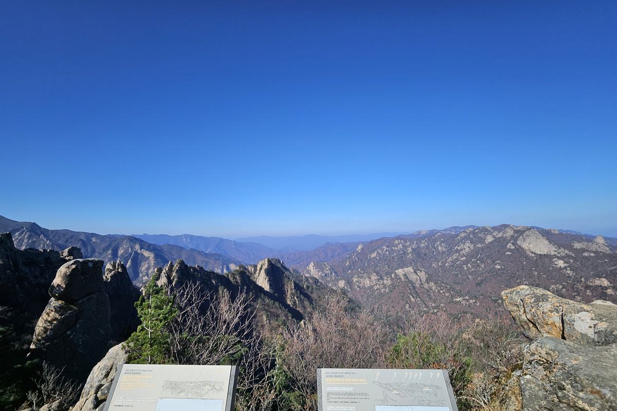
Odaesan's autumn colour does not peak on one day. The Korea National Arboretum's 2026 forecast puts the summit, Birobong, on Oct 12, Sangwonsa temple on Oct 19 and Woljeongsa temple on Oct 22. That is 10 days from top to bottom, so the trail you pick decides the week you should go.
There are two trails worth knowing: the summit hike from Sangwonsa to Birobong (3.4 km one way), and Seonjae-gil, a mostly flat 9 km forest walk along the stream between the two temples.
Jump to: Peak dates by spot · Birobong trail · Seonjae-gil · Which weekend · Getting there · FAQ
When does Odaesan peak in 2026?
The Korea National Arboretum (국립수목원) runs a map where you can tap any spot in Korea and get its forecast peak date. I tapped Odaesan point by point on Oct 4. The model is a statistical one built on weather data, and the Arboretum itself puts its hit rate at about 70%. Moving the pin even a little can shift the date by a day or two, so read the order more than the exact day.
| Spot | Trail | Forecast peak |
|---|---|---|
| Birobong 비로봉 (summit) | Birobong trail | Oct 12 |
| Sangwangbong 상왕봉 | ridge | Oct 14 |
| Jungdae Sajaam 중대 사자암 | Birobong trail | Oct 17 |
| Sangwonsa 상원사 | both | Oct 19 |
| Dongpigol 동피골 | Seonjae-gil | Oct 20 |
| Woljeongsa 월정사 | Seonjae-gil | Oct 22 |
The pattern holds on most big Korean mountains: colour starts at the top and walks down. On Odaesan the walk takes about 10 days.
The Birobong trail: Sangwonsa to the summit
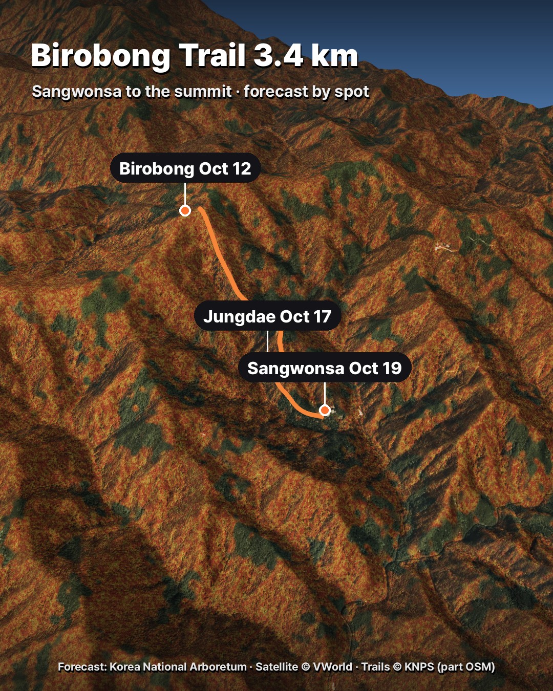
This is the trail most visitors choose, and Korea National Park Service (KNPS) says so on its own course page. It is 3.4 km from Sangwonsa to Birobong, about 1 hour 40 minutes one way, rated moderate. Plan 3 hours 10 to 3 hours 30 minutes for the round trip of 6.8 km.
- Sangwonsa 상원사 → Jungdae Sajaam 중대 사자암: 1.3 km, about 30 minutes. Mostly gentle.
- Jungdae → Birobong 비로봉: 2.1 km, about 1 hour 10 minutes, past Jeokmyeol Bogung 적멸보궁.
KNPS notes that apart from the last 400 m below the summit the whole trail is gentle, and that anyone of primary-school age or older can do it. It is a half-day hike.
One rule to know: during the autumn fire-prevention period, which runs from Nov 15 to Dec 15, you can only walk from the Sangwonsa car park up to Jeokmyeol Bogung. The summit is closed until the period ends.
Seonjae-gil: the easy valley walk
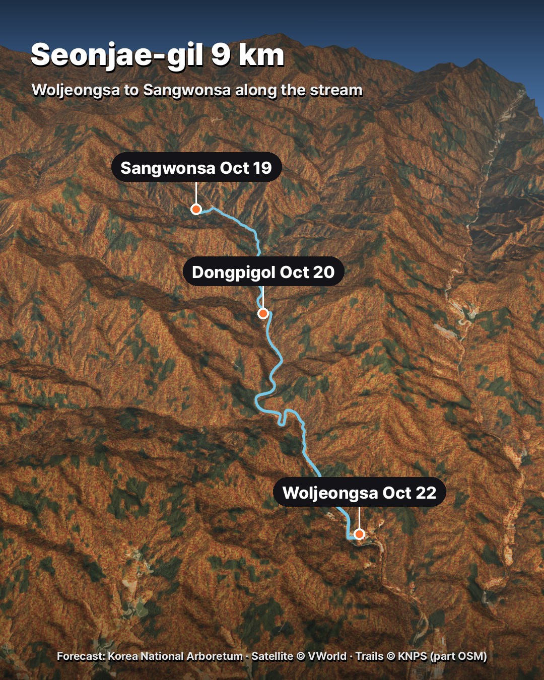
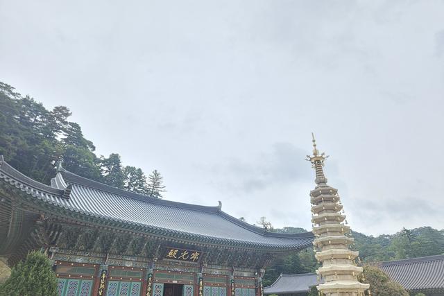
Seonjae-gil (선재길) follows the stream for 9 km from Woljeongsa to Sangwonsa. KNPS describes it as the path monks and pilgrims used before the road was built in the late 1960s. It is rated easy, takes about 3 hours 30 minutes, and is mostly flat. KNPS recommends it for families and older walkers, and says it is known for the autumn colour along the stream.
- Woljeongsa 월정사 (Il-ju-mun gate) → Dongpigol 동피골: 5.4 km, about 2 hours 10 minutes.
- Dongpigol → Sangwonsa 상원사: the rest of the way to the upper temple.
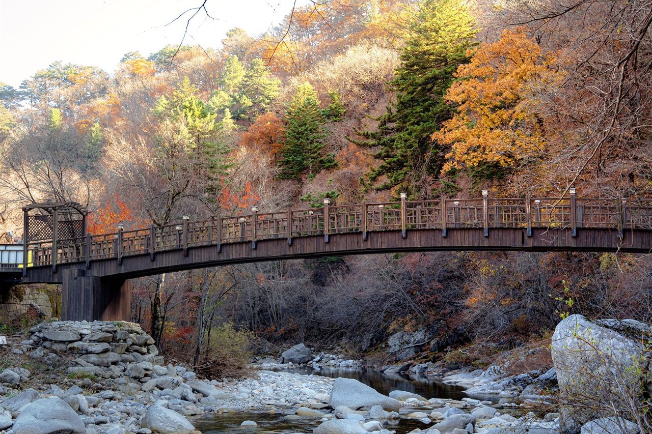
After heavy rain the stream can flood parts of the path. KNPS asks you to call the park office before you go: +82-33-332-6417. The good news: Seonjae-gil stays open during the fire-prevention period.
Picking a weekend for Odaesan
- Oct 10–11: Birobong trail, for colour at the summit.
- Oct 17–18: the upper half of Seonjae-gil and the lower part of the Birobong trail.
- Oct 24–25: all of Seonjae-gil down to Woljeongsa.
I really don't like crowds, so if I had only one day I would pick Seonjae-gil on a weekday around Oct 20. You can also do both: walk Seonjae-gil up to Sangwonsa and then hike Birobong. That is 9 km plus a 6.8 km round trip, so it is a full day.
How to get to Odaesan by public transport
- Take the KTX on the Gangneung Line to Jinbu (Odaesan) Station 진부(오대산)역.
- The local buses start from Jinbu Intercity Bus Terminal 진부시외버스터미널, not the KTX station, so take a local bus or a taxi into Jinbu, or a taxi straight to the temples.
- From Jinbu, bus 226 runs to Sangwonsa nine times a day. According to Pyeongchang County's transit timetable, the first leaves Jinbu at 9:05 am and reaches Sangwonsa about 45 minutes later. One earlier bus, 225, leaves at 7:50 am but only goes as far as Woljeongsa (8:10 am).
Timetables change, so check with the bus company, Pyeongchang Unsu (평창운수, +82-33-332-4209), or ask at the terminal. By car, leave the Yeongdong Expressway at Jinbu IC. Woljeongsa and Sangwonsa each have a car park at the start of their trail.
Check the forecast again before you go
The dates above are what the map showed on Oct 4, and they can move as the weather comes in. The site is in Korean, but it is easy: open the Arboretum's peak foliage map, zoom to Odaesan and tap the spot you plan to walk. The date appears right away.
FAQ
When is Odaesan's fall foliage peak in 2026?
The Korea National Arboretum forecasts Birobong summit around Oct 12, Sangwonsa around Oct 19 and Woljeongsa around Oct 22.
Do I need a reservation to hike Odaesan?
No. Neither the Birobong trail nor Seonjae-gil needs one. Just keep to the trail hours.
Which Odaesan trail is easiest?
Seonjae-gil. KNPS rates it easy and says it is mostly flat.
Can I hike Birobong in November?
Until Nov 14, yes. From Nov 15 the fire-prevention period limits you to the section from Sangwonsa to Jeokmyeol Bogung.
What to watch next
The Korea Meteorological Administration also observes Odaesan's autumn colour. When it reports this year's peak, I will add it here next to the forecast.
More fall foliage guides
Sources: Korea National Park Service, Odaesan course guide and trail hours (knps.or.kr) · Korea National Arboretum, 2026 peak foliage map (knpn.nature.go.kr) · Pyeongchang County transit timetable (pyeongchang-pti.kr) · Trail lines © Korea National Park Service (data.go.kr), with a short section from OpenStreetMap contributors · Satellite © VWorld
— SeoulAslan


Comments
Post a Comment