
 SetPaying for Seoul transport
 Hi, I’m SeoulAslan
Haeparang Trail Course 1 Busan: Route, Transit, Time (2026)
Checked Oct 16, 2026

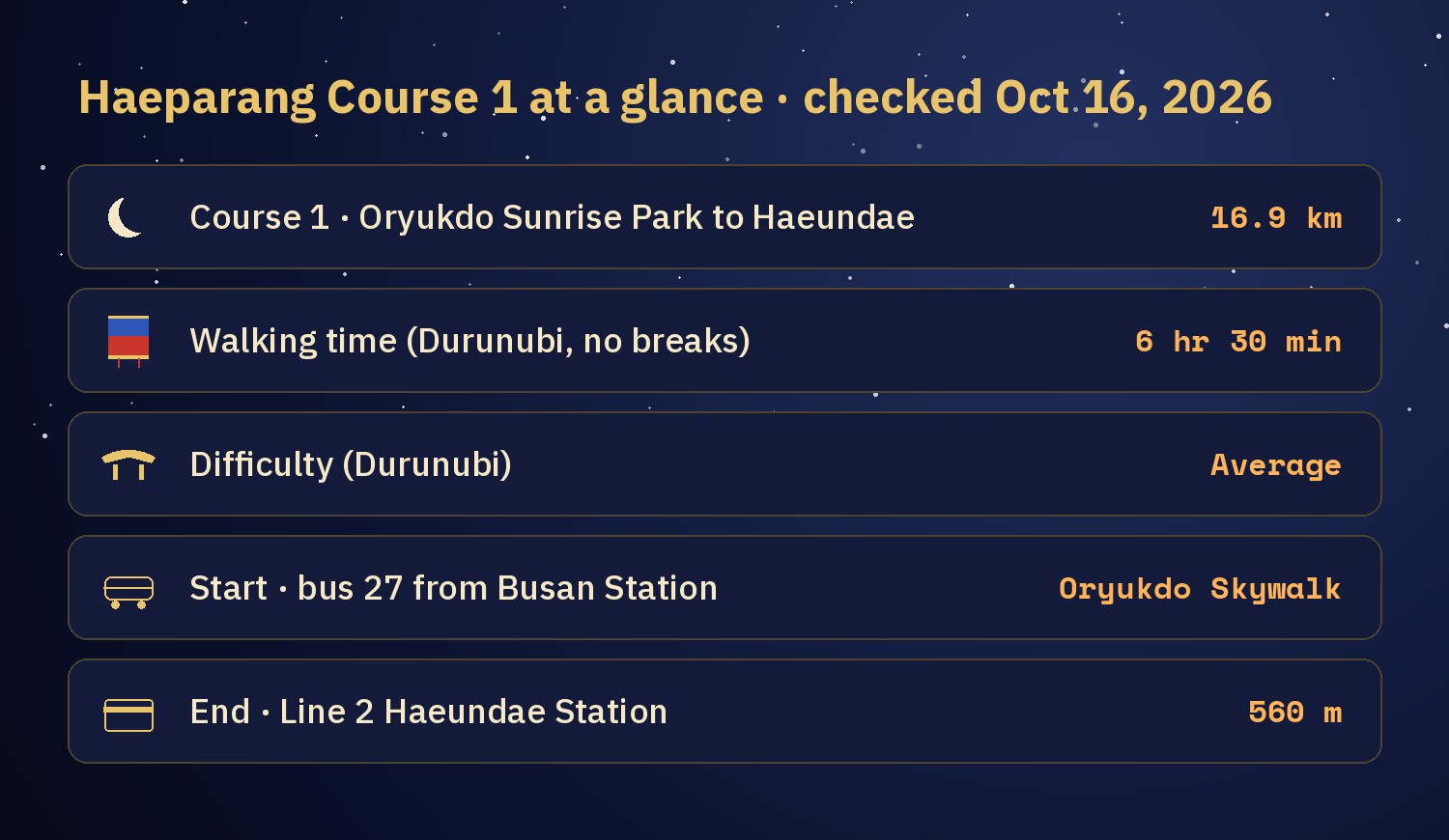
Haeparang Trail Course 1 (해파랑길 1코스) is a 16.9 km coastal walk in Busan, from Oryukdo Sunrise Park (오륙도해맞이공원) to Haeundae Beach (해운대해수욕장). Durunubi, the official trail site, gives 6 hours 30 minutes without breaks and rates it "Average". It starts and ends in different places, so the practical questions are how to reach the start and how to get back. From Busan Station, city bus 27 goes to the Oryukdo Skywalk stop beside the start, and Line 2 Haeundae Station is 560 m from the end.
I am working through Korea's long-distance Dulle-gil trails one course at a time, asking myself which one I would walk and which one comes after it. This is the first. I have not walked Course 1 yet, so every number here comes from Durunubi, the Korea Tourism Organization (KTO) and Busan city pages, checked on Oct 16, 2026. Where a time or fare is my own estimate, I say so.
Jump to: What the trail is · Sections and timing · Getting to the start · Getting back · Where to stay · What you pass · Toilets · Durunubi app · Season · Food · FAQ
What is the Haeparang Trail, and where is Course 1?
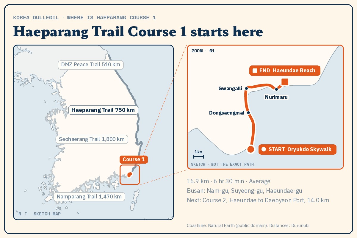
Haeparang Trail (해파랑길) runs along Korea's east coast from Oryukdo in Busan to Tongiljeondangdae (the Unification Observatory) in Goseong, Gangwon Province. It has 50 courses and opened in May 2016. The official length is about 750 km, but the course lengths on Durunubi add up to 734.4 km. I use the course figures when I give distances and the official figure only for the whole trail.
Haeparang is one of four trails that together make the Korea Dulle-gil (코리아둘레길), about 4,500 km around the country. The other three are Namparang (1,470 km), Seohaerang (1,800 km) and the DMZ Peace Trail (510 km). Course 1 is about 2.3% of the Haeparang course total. Namparang Trail also starts from Oryukdo Sunrise Park, so the park is where the east and south trails begin together.
How long are the sections, and how much time should you plan?
| Section | Distance |
|---|---|
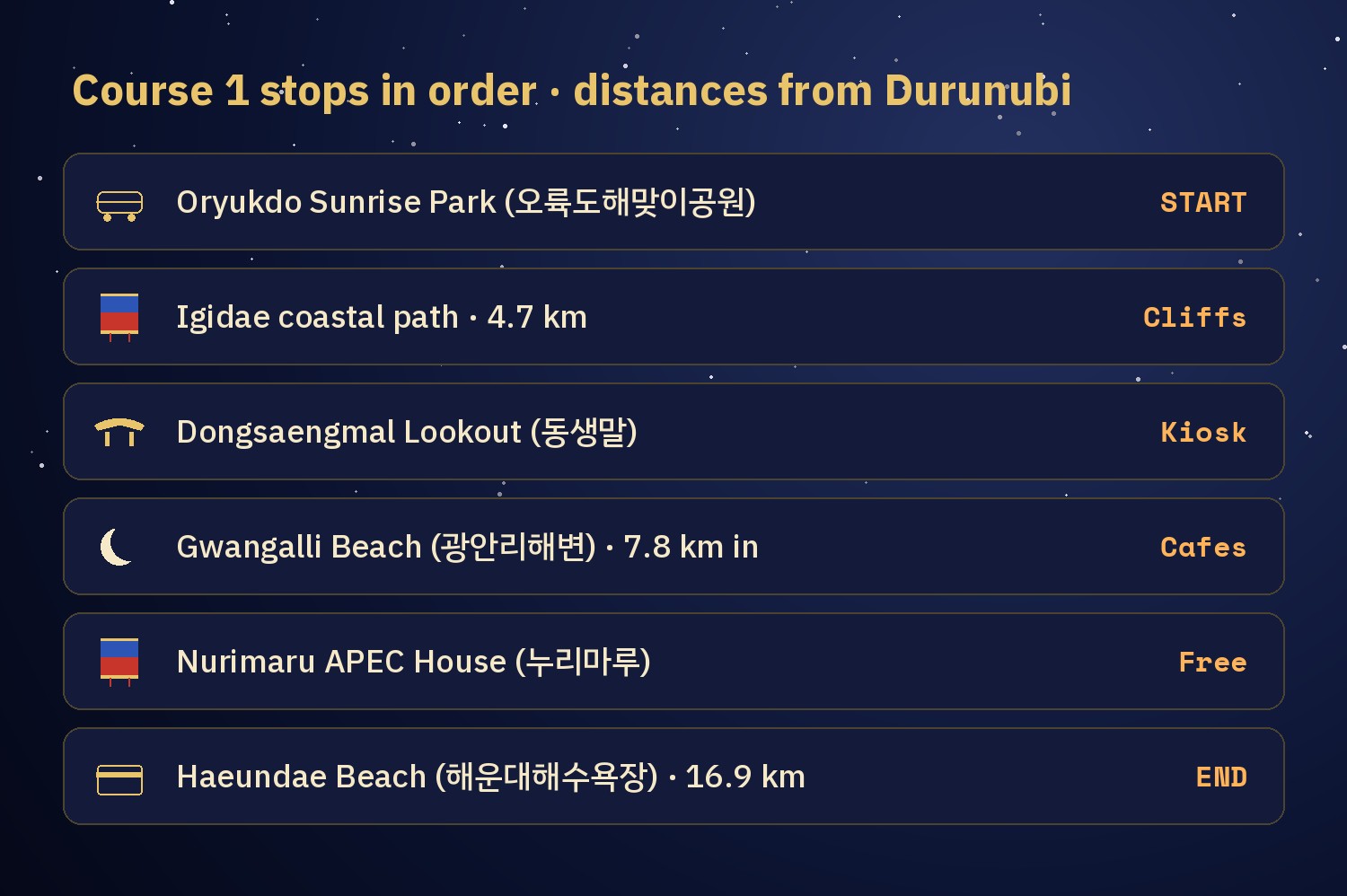
| Oryukdo Sunrise Park to Dongsaengmal (동생말) | 4.7 km |
| Dongsaengmal to Gwangalli Beach (광안리해변) | 3.1 km |
| Gwangalli Beach to APEC House (누리마루 APEC하우스) | 7.6 km |
| APEC House to Haeundae | 1.5 km |
The four add up to 16.9 km. The longest is Gwangalli to APEC House, 7.6 km, which is 45% of the course. Durunubi gives only the 6 hr 30 min total, so I spread it over the sections by distance. If you start at 9:00, that puts you at Dongsaengmal around 10:50, Gwangalli around 12:00, APEC House around 14:55 and Haeundae around 15:30. Breaks are not in that figure.
- Durunubi time as it is: 6 hr 30 min. Start 9:00, finish 15:30.
- With a 1-hour lunch and 1 hour of rests and photos (my arithmetic): 8 hr 30 min. Start 9:00, finish 17:30.
- Start at 8:00 instead: finish 16:30.
Durunubi's safety guide suggests walking between 9:00 and 18:00 in summer and between 9:00 and 17:00 in winter. Sunset in Busan on Oct 16 is about 17:49 (calculated), so a relaxed day finishes close to dark. That is why I look at splitting the course over two days first, and I explain how below.
How do you get to the start without a car?
- From Busan Station (부산역): take city bus 27 from the bus stop at the station and get off at Oryukdo Skywalk (오륙도스카이워크).
- From the subway: take Line 2 to Kyungsung Univ.-Pukyong National Univ. Station (경성대·부경대역), go out Exit 5 and take bus 24, 27 or 131 to the same stop.
- Watch the stop name. Sources call it Oryukdo Skywalk (오륙도스카이워크) or Oryukdo SK View rear gate (오륙도 SK뷰 후문). Both names point to the same area, so search for the Skywalk pin below on Naver Map.
The start is next to the Oryukdo Skywalk. Oryukdo Sunrise Park has a paid public car park, but you will not need it if you ride the bus. A private travel guide, Koreatodo, puts bus 27 from Busan Station at about 47 minutes, and bus 24, 27 or 131 from Exit 5 at about 18 minutes. For a start from the Haeundae side, my own estimate is about 1 to 1 hr 20 min door to door. Check the live time in Naver Map before you leave. If you have not used it yet, Naver Map vs Kakao Map vs Google Maps in Korea explains why Naver is the one to use here, and T-money vs Climate Card vs WOWPASS covers transit cards.
How do you get back after the walk?
This is the part that makes a one-way trail awkward. These are the options I am weighing, from simplest.
- Walk to Haeundae and ride Line 2 home. Haeundae Station is 560 m from the end. Express bus 1003 stops 160 m from the end and goes to Busan Station.
- Bail out early. Gwangan Station on Line 2 is close to Gwangalli Beach. Dongbaek Station Exit 1 and the Dongbaekseom Entrance stop of bus 1003 are by Dongbaekseom, so you can leave with 1.5 km still to go.
- Split it over two days. Day 1 is Oryukdo to Gwangalli Beach, 7.8 km, about 3 hours by Durunubi's proportions. Day 2 is Gwangalli to Haeundae, 9.1 km, about 3 hr 30 min. Line 2 links Gwangan Station and Haeundae, so each day ends and begins next to a station.
- Walk only the Igidae half and turn around. Oryukdo to Dongsaengmal and back is 9.4 km, about 3 hr 40 min by the same proportions. You come back to where you started, and you see the most dramatic part of the coast.
- Take a taxi from Haeundae back to the start. A Busan standard taxi costs 4,800 won for the first 2 km and 100 won per 132 m after that (rate from June 1, 2023). If the road distance is about 15 km, I estimate 15,000 to 20,000 won before night surcharge and tolls. That is my estimate, not a quoted fare.
I would go to the start by transit, walk to Haeundae and take Line 2 back. After 16.9 km my legs will not want a transfer. If daylight is short, I will take the two-day version. If I only want a taste, I will do the Igidae out-and-back.
If you drive, the end of the course is the hard part. Line 2 Jung-dong Station has a transfer car park with 167 spaces (Busan city list, updated Mar 23, 2026), one stop from Haeundae Station. The car park at Dongbaek Park by Nurimaru is paid and fills up on holidays, so Busan city recommends public transport there.
Where should you stay?
I am not recommending a hotel, only a base. Because the end is Haeundae and the start is far to the south-west, there are two sensible bases.
- Haeundae. You finish at your door, and you can eat there after the walk. The cost is a long ride out on the first morning.
- Near Gwangalli Beach or Gwangan Station. This works well for the two-day split, because Day 1 ends at the beach and Day 2 starts there. It is also on Line 2.
- Near Busan Station. Bus 27 leaves from the station, so there is no transfer on the way out. At the end you ride Line 2 back.
What do you pass on Course 1?
Oryukdo Skywalk (오륙도 스카이워크). Oryukdo is a group of rocky islands off Yongho-dong. It was designated Scenic Site No. 24 on Oct 1, 2007. The five islands are Usakdo, Suri-seom, Songgot-seom, Gul-seom and Deungdae-seom. Usakdo, closest to land, splits in two at high tide and joins at low tide, so you can count five or six. An old book, the Dongnae-bu-ji (『동래부지』), says the peaks look like six from the east and five from the west, hence the name Oryuk, "five-six". The Skywalk has a glass-floor section. It is open 9:00 to 18:00 from October to May (last entry 17:50) and 9:00 to 19:00 from June to September. Entry is restricted in snow, rain and strong wind. Wheelchairs can get as far as the entrance of the glass bridge.
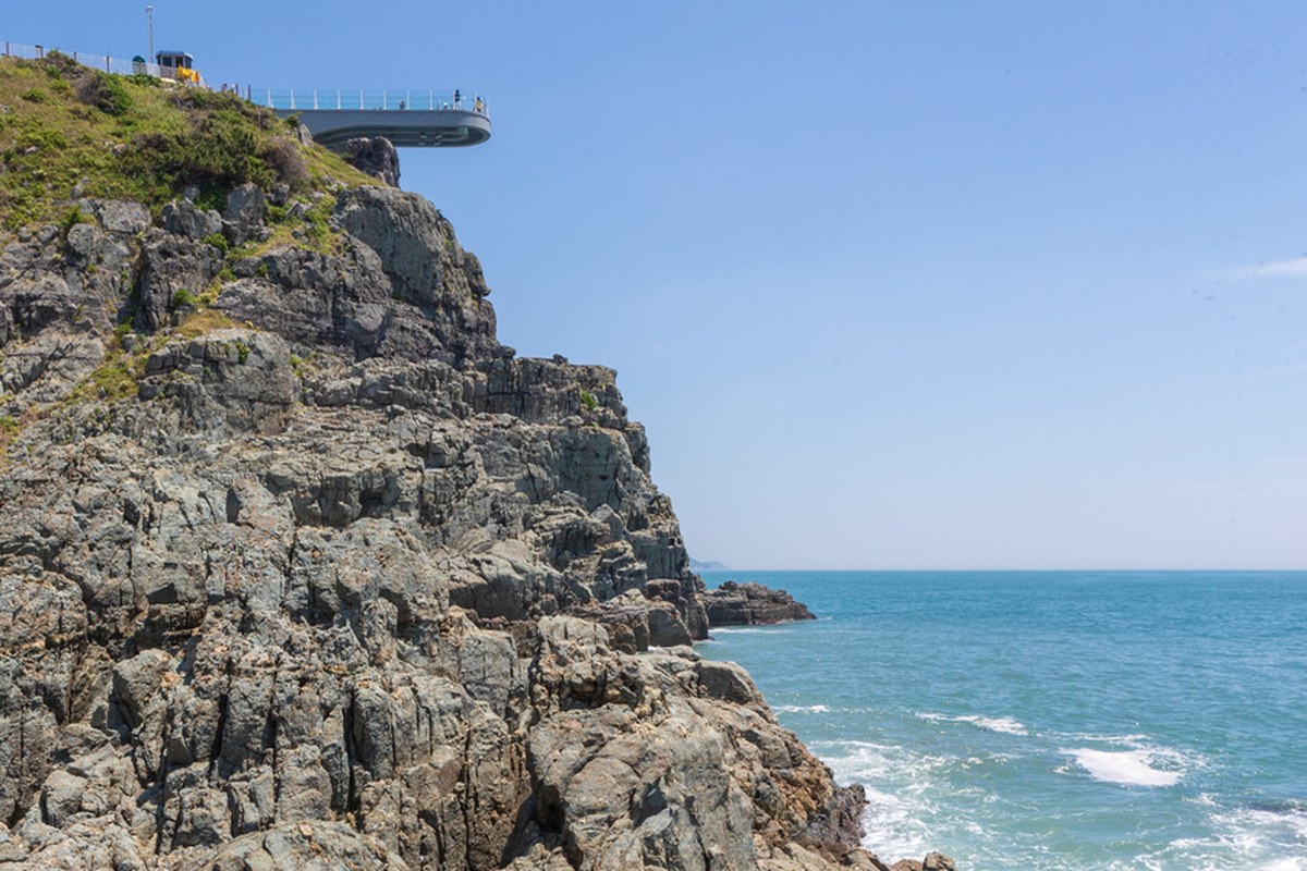
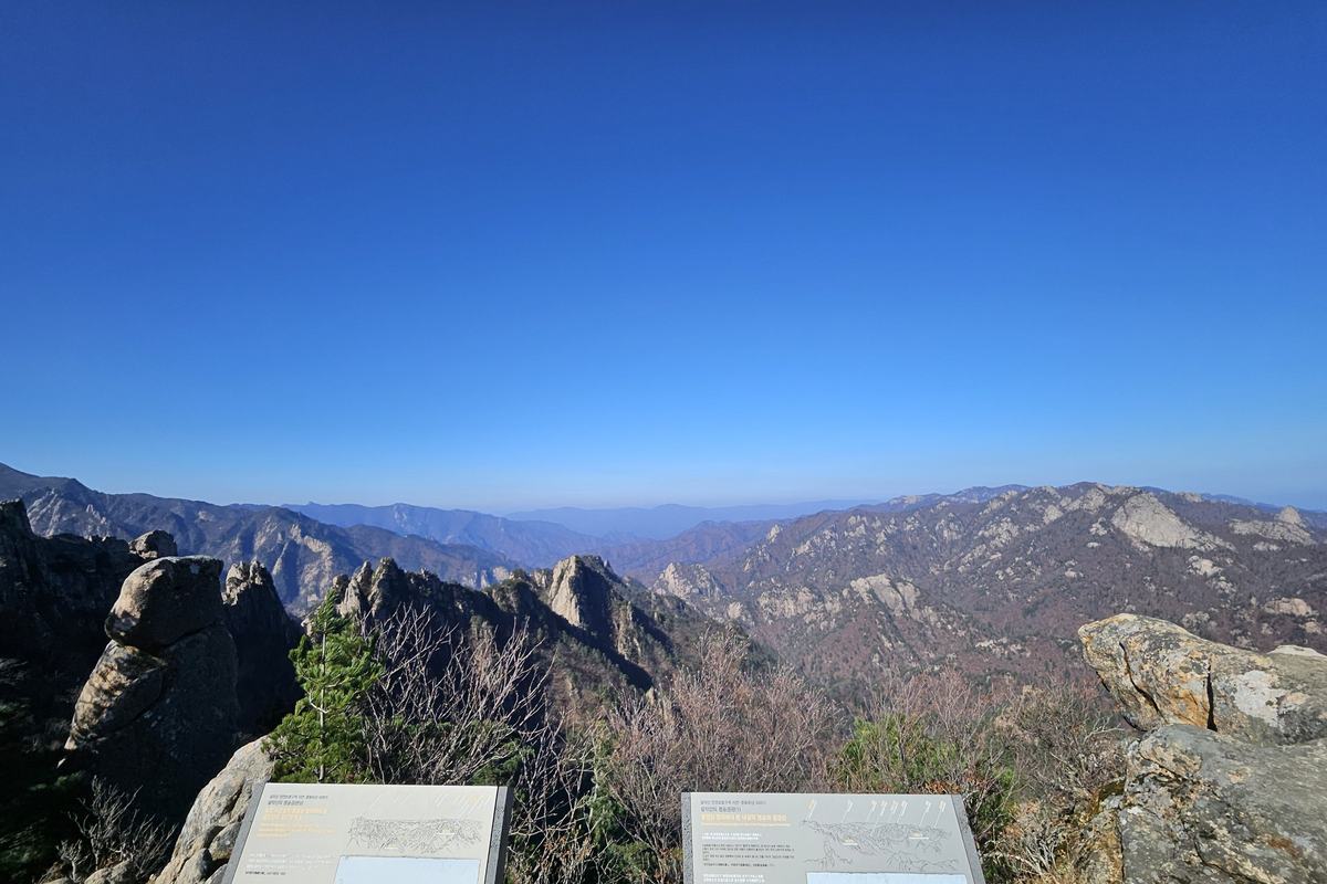
Igidae Coastal Path (이기대 해안 산책로). The 4.7 km from Oryukdo Sunrise Park to Dongsaengmal is the Igidae section. A coastal path runs along cliffs above the sea and crosses 5 suspension bridges, 127 m in total. Sources disagree on timing: the Busan geopark gives 3.95 km and an average of 2 hours for the path, and Visit Busan gives 4.7 km and about 2 hr 30 min from Dongsaengmal to Oryukdo. I plan on the longer figure. Along the coast you can see round pits that look like dinosaur footprints. They are potholes, made when pebbles and sand caught in a crack in the rock were spun by waves and wore the stone away. The name Igidae has several stories. The Dongnae-yeongji (『동래영지』) says two courtesans' graves lay 15 ri south of the naval station, and another tale says that during the Imjin War (1592 to 1598) two courtesans embraced a Japanese general and jumped into the sea.
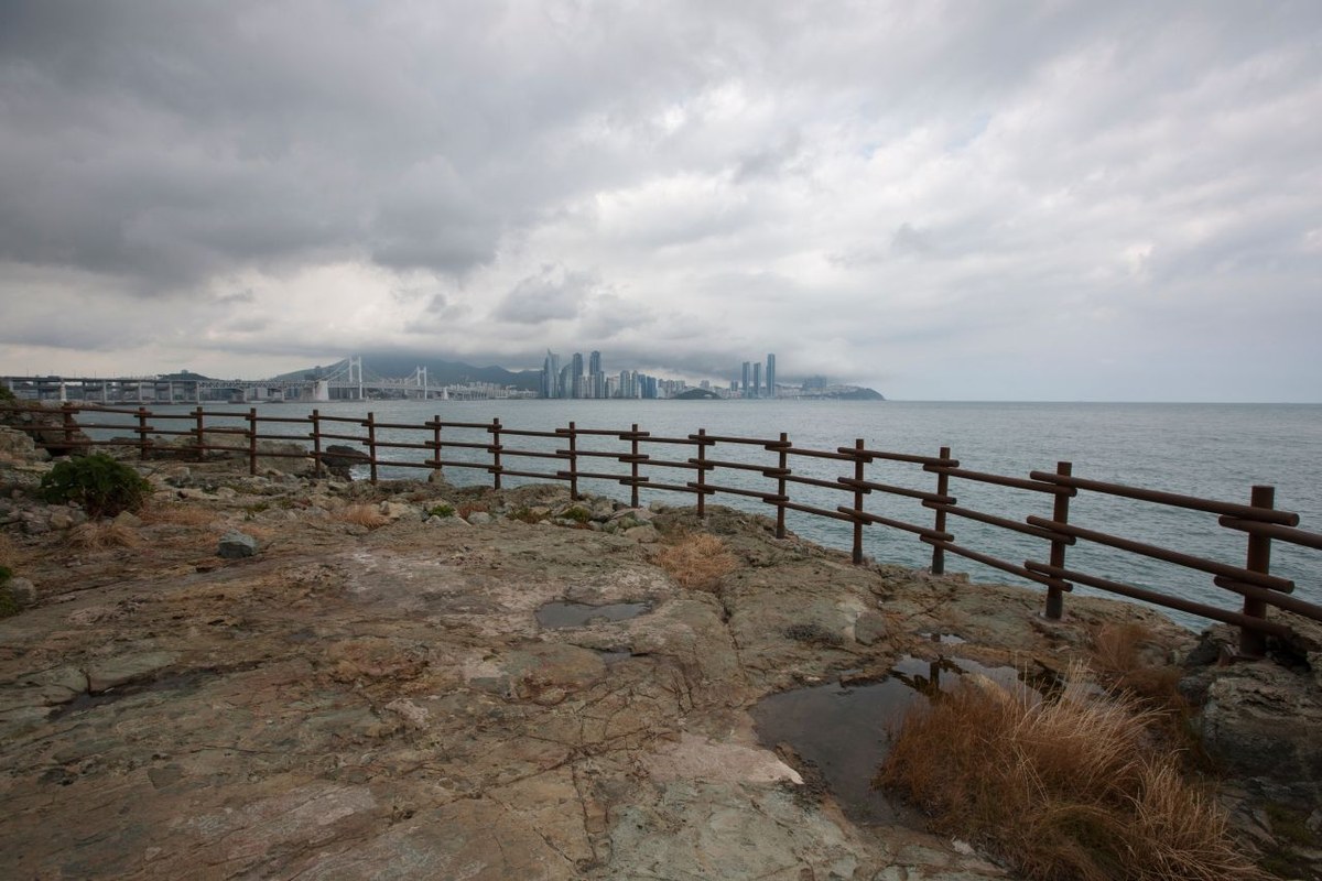
Gwangalli Beach and Gwangan Bridge (광안리해변, 광안대교). Gwangalli Beach in Suyeong-gu runs from Namcheon-dong at the west end to Millak-dong at the east end and is open all year. Gwangan Bridge is a double-deck bridge over the sea from Namcheon-dong toward the Centum City area of Haeundae-gu. Including its approach bridges it is 7.42 km long, with a 900 m suspension section. A temporary section opened for the 2002 Asian Games and the bridge opened formally in 2003. Durunubi lists its night view as a highlight and suggests starting the walk two hours before sunset. If you reach Gwangalli at dusk, it works well after a daytime pass through Igidae.
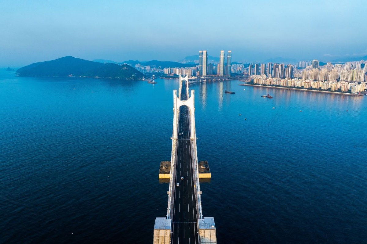
Dongbaekseom and Nurimaru (동백섬, 누리마루). Dongbaekseom (Dongbaek Island) used to be a real island. Sand carried by the Chuncheon stream built up until it joined the west end of Haeundae Beach. Its name refers to camellias, but pine trees now form the denser forest. It became a Busan Monument on March 9, 1999, and is open all year. At the top there is a statue of Choe Chiwon (최치원) and a memorial stone. From the island you see Gwangan Bridge to the west, Dalmaji Hill to the east and Oryukdo to the south-west. It is where you see the place you started the same morning. The name Haeundae joins "haeun" (海雲, sea cloud), which Choe Chiwon is said to have carved on a rock on the island, with "dae" (臺, a high place). That carving is Busan Monument No. 45, but it is beside a coastal guard post below the loop road, and the public cannot enter.
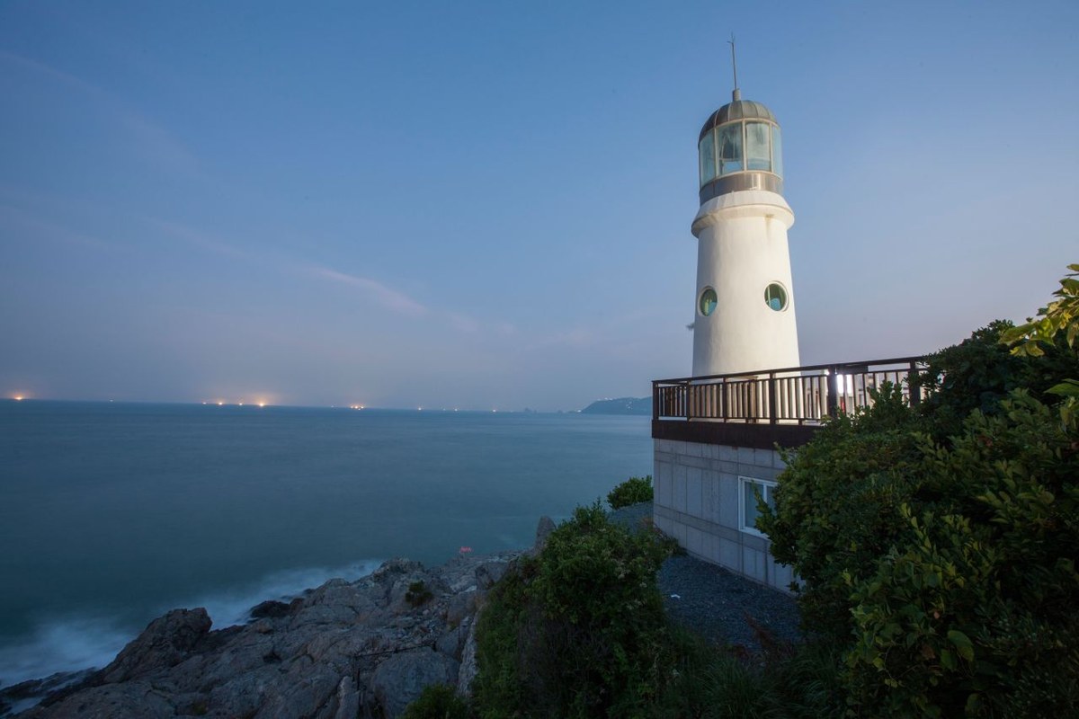
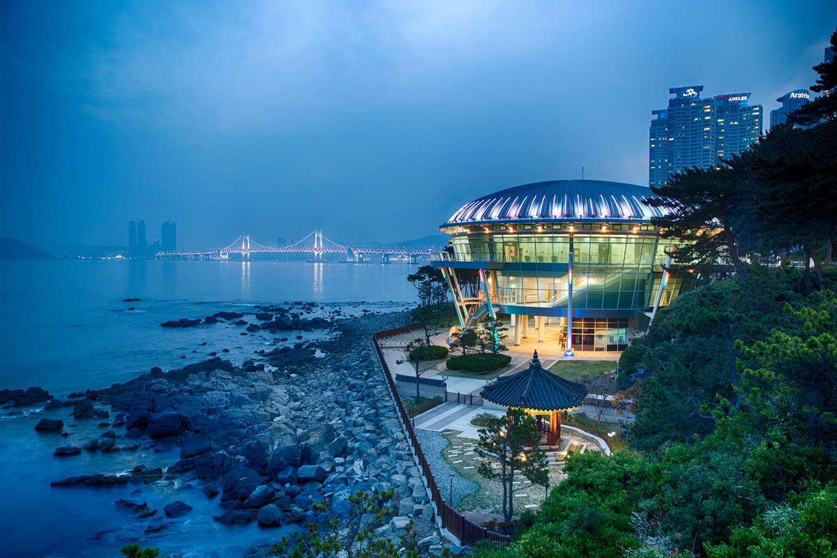
Nurimaru APEC House (누리마루 APEC하우스). Leaders of 21 Asia-Pacific economies met here for the APEC summit and lunch on Nov 19, 2005. "Nuri" means world and "maru" means summit in pure Korean. The APEC Memorial Hall on the third floor keeps the leaders' desks and chairs, microphones, name plates and carpet as they were. It is open daily 9:00 to 18:00 (last entry 17:00), closed on the first Monday of every month, and admission is free.
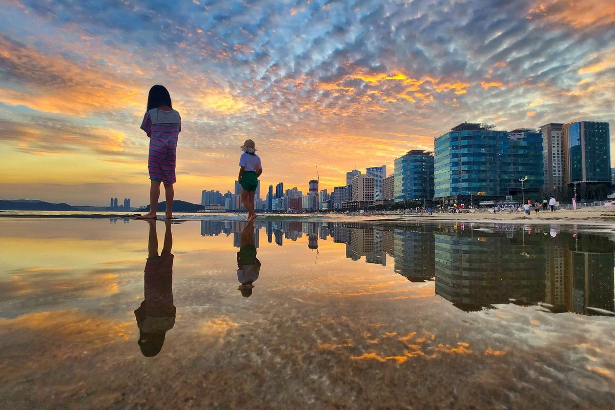
Haeundae Beach (해운대해수욕장). The course ends in front of the beach. Haeparang Course 2 starts from the same spot. Durunubi describes Haeundae as a busy tourist area you can combine with the walk, and lists a kiosk and toilets at the beach as course facilities.
Where are the toilets and kiosks?
These are the places Durunubi lists for Course 1.
- Toilets (6): Oryukdo Haeparang Trail information office, Eoul Madang (어울마당) at Igidae, Gwangalli Beach, Gwangalli Waterside Park, Dongbaekseom and Haeundae (portable toilets included).
- Kiosks (4): Eoul Madang, Dongsaengmal, Gwangan Beach and Haeundae Beach.
On the Igidae section, the only toilet and kiosk stops are Eoul Madang and Dongsaengmal, so fill your water bottle at the start. Gwangalli and Haeundae are busy areas with convenience stores and toilets close together.
How does the Durunubi app work, and is it in English?
Durunubi (두루누비) is the free app from the Korea Tourism Organization. The App Store lists it in Korean and English, and the Google Play name is "Durunubi". It covers course search, GPS follow mode, QR stamps and the walking certificate application. You log in once through Tour OnePass, the KTO single sign-on, with a social account. First login creates a Durunubi account automatically. Allow location access so the follow mode can record your walk.
The English course pages are where I took the English names in this guide. Some notices, like the detour below, are only in Korean on the site, so I translate them here. There are two ways to collect a stamp, and you can use either or both:
- QR stamp. There is a QR code on the signboard at the start or end of each course. Tap the QR button at the bottom of the app and scan it. For Course 1 the start QR is at 137 Oryukdo-ro beside the Haeparang information office, and the end QR is inside the Haeundae Comprehensive Tourist Service Center at 264 Haeundae Haebyeon-ro.
- Follow mode. Pick the course in the app and walk with follow mode on. The course has 7 required waypoints, and passing 3 of them counts as completed. Direction does not matter, and you can start mid-course.
If you step off the course for a meal or a sight and come back, it still counts. Do not end follow mode until you have finished, because you cannot resume afterwards. Follow mode does not work in airplane mode, and battery-saving mode can make the recording unstable. If your phone dies, open the app again and a resume window appears.
The walking certificate is awarded per trail. Collect the stamps for every Haeparang course and apply from the My Page menu after logging in. Approved certificates and a souvenir arrive by post, and the souvenir can change. You can apply once per trail, and your stamps are not reset afterwards. Stamps collected by unfair means such as driving may not qualify, so walk the courses. For Haeparang, having the physical stamp at every course start also qualifies.
When is the best time to walk it?
| Season | Average | Rain | Wind |
|---|---|---|---|
| Spring (Mar to May) | 13.6°C | 386.5 mm | 3.7 m/s |
| Summer (Jun to Aug) | 23.8°C | 781.7 mm | 3.5 m/s |
| Autumn (Sep to Nov) | 17.5°C | 290.6 mm | 3.2 m/s |
| Winter (Dec to Feb) | 5.0°C | 117.6 mm | 3.4 m/s |
These are Korea Meteorological Administration normals for Busan, 1991 to 2020. My pick is mid-October to early November. Autumn has the lightest wind of the four seasons and a pleasant average of 17.5°C, and mobile high-pressure systems mean mostly clear skies. Purple haeguk (해국), a coastal aster, blooms at Igidae in autumn and yellow gat-godeulppaegi in late autumn.
The days are short. Sunset is about 17:49 on Oct 16, 17:19 on Nov 15 and 17:13 on Dec 15 (calculated for Busan, so it may differ from official tables by a few minutes), so start early. Spring is my second choice, though northeasterly winds make it chilly and it gets 386 mm of rain. Summer is the wettest at 782 mm and does not suit the Igidae cliff path. Winter is 5.0°C with strong wind.
What about rain, children and parents?
In rain I would skip Igidae. The Skywalk restricts entry in snow, rain and strong wind, and Igidae is a sea-cliff path with suspension bridges. Instead I would take Line 2 to Gwangan Station, walk from Gwangalli Beach to Haeundae (9.1 km) and shelter inside Nurimaru, which is free, except on the first Monday of the month.
With children or parents I would start with the end section. APEC House to Haeundae is 1.5 km past Dongbaekseom and the beach, about 35 minutes on Durunubi's proportions. A 2019 KTO article describes the Gwangalli promenade as flat enough for strollers and wheelchairs. Igidae is different: wheelchairs can reach only the glass bridge entrance, and the path has 5 suspension bridges.
Is there a detour or construction on the course?
Yes. On Oct 16 the Durunubi page for Course 1 carried a caution notice in Korean. Roadworks around the Suyeong Bay Yacht Center (수영만요트경기장) block the inner path. Follow the sidewalk along Haeundae Haebyeon-ro toward Marine City and go around. A notice like this disappears when the work is done, so open the course page on Durunubi once more before you leave and check the caution section.
Where can you eat near the course?
I chose places listed on KTO's tourist information database and Visit Busan, the official Busan tourism site, and I describe only what those pages say. The map links below open Naver Map.
- Start side, Hapcheon Gukbap (합천국밥집), Yongho-dong. A pork and rice soup (dwaeji-gukbap) restaurant with a clear broth and pork without a gamey smell. It is about 1.7 km in a straight line from Oryukdo Sunrise Park.
- Middle, Jamae Gukbap (자매국밥), Millak. Rice soup made with a broth from pig's head meat, plus boiled pork slices (suyuk). Closed on Sundays.
- Middle, Millak Raw Fish Town (민락회타운). You pick fish at the live-fish market on the ground floor and eat at restaurants upstairs. Open every day from 9:00 to 2:00 though each shop differs, with no closing day. The Millak Raw Fish Town car park and the Millak Waterside Park car park are both paid. The walk from Gwangan Station Exit 3 takes about 18 minutes.
- End side, Haeundae Market (해운대시장). Open 9:00 to 22:00, with pork and rice soup, kalguksu noodles, tteokbokki, fritters and twisted doughnuts, as well as raw fish and grilled hagfish (gomjangeo) shops. It is a 5-minute walk from Haeundae Station Exit 3.
- End side, Haeundae Gwajiip Daegu-tang (해운대기와집대구탕). It serves one dish, cod stew, and is described as having a view of Haeundae and Gwangan Bridge. It is on the Dalmaji-gil side, so I see it as a separate dinner trip.
Naver Map pins
| # | Place | Naver Map |
|---|---|---|
| 1 | Oryukdo Skywalk (오륙도 스카이워크) · start | Open |
| 2 | Dongsaengmal Lookout (이기대공원 동생말전망대) | Open |
| 3 | Gwangalli Beach (광안리해수욕장) | Open |
| 4 | Nurimaru APEC House (누리마루 APEC하우스) | Open |
| 5 | Haeundae Beach (해운대해수욕장) · end | Open |
| 6 | Hapcheon Gukbap (합천국밥집) | Open |
| 7 | Jamae Gukbap (자매국밥) | Open |
| 8 | Millak Raw Fish Town (민락회타운) | Open |
| 9 | Haeundae Market (해운대시장) | Open |
| 10 | Haeundae Gwajiip Daegu-tang (해운대기와집대구탕) | Open |
FAQ
How long does Haeparang Trail Course 1 take?
Durunubi gives 6 hr 30 min for 16.9 km without breaks, and rates it "Average". With a lunch and rests I plan for about 8 hr 30 min.
Which bus goes to the start from Busan Station?
City bus 27 from the bus stop at Busan Station to Oryukdo Skywalk. From Line 2 Kyungsung Univ.-Pukyong National Univ. Station Exit 5 you can take bus 24, 27 or 131.
Can I walk part of Course 1?
Yes. You can leave at Gwangan Station near Gwangalli Beach, or at Dongbaek Station by Dongbaekseom. Oryukdo to Dongsaengmal and back is 9.4 km.
Is the Durunubi app needed for Course 1?
No. You can walk it without the app. The app is for the QR stamps at the start and end, and for follow mode, which counts a course as done after 3 of its 7 waypoints.
What can you walk after Haeundae?
Course 2 starts in front of Haeundae Beach, where Course 1 ends. It runs from Haeundae to Daebyeon Port in Gijang, 14.0 km, 5 hours, rated easy. The Course 2 start QR is the same Haeundae Comprehensive Tourist Service Center as Course 1's end. It also has a caution notice: work on the Jukdo Park path runs from Sep 14 to Oct 23, 2026, and the area near the Banyan Tree hotel is closed, so you detour via Orangdae and Haegwangsa to Gijang Haean-ro (as of Oct 16). Course 3 goes from Daebyeon Port to Imrang Beach, 16.7 km, 6 hours, "Average".
To go the other way, Namparang Trail Course 1 runs from Oryukdo Sunrise Park to Busan Station, 18.9 km, 7 hours, "Average", past UN Peace Park and Sujeongsan Family Sports Park. Its start QR is the same 137 Oryukdo-ro as Course 1's. I will compare the two before choosing my next walk, and I will update the Checked date here when Durunubi's data changes.
Sources
- Durunubi (Korea Tourism Organization), course pages for Haeparang 1, 2 and 3 and Namparang 1, the Haeparang Trail introduction, the safety travel guide, the use guide and FAQ, checked Oct 16, 2026
- Durunubi app listing on the App Store, checked Oct 16, 2026
- Korea Tourism Organization TourAPI: Oryukdo Skywalk, Oryukdo Sunrise Park, Dongsaengmal Lookout, Gwangalli Beach, Gwangan Bridge, Dongbaekseom, Nurimaru APEC House, Haeundae Beach and the five restaurants (Korean)
- Busan Metropolitan City (Korean): Nurimaru APEC House visitor guide, scenic sites, Gwangan Bridge article, public car park rates, transfer car park list (updated Mar 23, 2026), taxi fares, Busan geopark Igidae page and the Igidae suspension bridge article
- Nam-gu Office, Oryukdo Skywalk guide (Korean) · Haeundae-gu Office, Dongbaek Park guide (Korean)
- Koreatodo (private travel guide): bus times to Oryukdo Skywalk
- Visit Busan (official Busan tourism site): Oryukdo Skywalk, Igidae coastal path, Hapcheon Gukbap, Jamae Gukbap, Millak Raw Fish Town, Haeundae Market
- Korea Meteorological Administration, Busan climate normals 1991 to 2020 (Korean) · sunset times calculated with the NOAA formula
- Korea Heritage Service portal and the Encyclopedia of Korean Culture (Korean): Oryukdo, Haeundae Dongbaekseom, Gwangan Bridge
- Photos: Korea Tourism Organization photo gallery, Korea Open Government License Type 1 (credited; cropped to size). Coastline: Natural Earth (public domain)
— SeoulAslan


Comments
Post a Comment